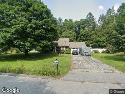
23 Sunset Dr Brooklyn, CT 06234
Brooklyn NeighborhoodEstimated Value: $368,166 - $425,000
4
Beds
2
Baths
1,499
Sq Ft
$266/Sq Ft
Est. Value
About This Home
This home is located at 23 Sunset Dr, Brooklyn, CT 06234 and is currently estimated at $398,292, approximately $265 per square foot. 23 Sunset Dr is a home located in Windham County with nearby schools including Brooklyn Elementary School and Brooklyn Middle School.
Ownership History
Date
Name
Owned For
Owner Type
Purchase Details
Closed on
Jul 30, 2014
Sold by
Brissette Tracie L
Bought by
Brissette Tracie L and Stubbs Andrew
Current Estimated Value
Home Financials for this Owner
Home Financials are based on the most recent Mortgage that was taken out on this home.
Original Mortgage
$211,921
Outstanding Balance
$61,929
Interest Rate
4.5%
Mortgage Type
FHA
Estimated Equity
$336,363
Purchase Details
Closed on
Sep 13, 2008
Sold by
Creed 3Rd John P and Creed Diana L
Bought by
Stubbs Andrew J and Brissette Tracie L
Home Financials for this Owner
Home Financials are based on the most recent Mortgage that was taken out on this home.
Original Mortgage
$228,656
Interest Rate
6.58%
Purchase Details
Closed on
Mar 31, 2005
Sold by
Nelson Kevin C and Nelson Laure M
Bought by
Creed 3Rd John P and Creed Diana L
Create a Home Valuation Report for This Property
The Home Valuation Report is an in-depth analysis detailing your home's value as well as a comparison with similar homes in the area
Home Values in the Area
Average Home Value in this Area
Purchase History
| Date | Buyer | Sale Price | Title Company |
|---|---|---|---|
| Brissette Tracie L | -- | -- | |
| Brissette Tracie L | -- | -- | |
| Stubbs Andrew J | $232,246 | -- | |
| Stubbs Andrew J | $232,246 | -- | |
| Creed 3Rd John P | $265,000 | -- | |
| Creed 3Rd John P | $265,000 | -- |
Source: Public Records
Mortgage History
| Date | Status | Borrower | Loan Amount |
|---|---|---|---|
| Open | Brissette Tracie L | $211,921 | |
| Closed | Brissette Tracie L | $211,921 | |
| Previous Owner | Nelson Kevin | $228,656 |
Source: Public Records
Tax History Compared to Growth
Tax History
| Year | Tax Paid | Tax Assessment Tax Assessment Total Assessment is a certain percentage of the fair market value that is determined by local assessors to be the total taxable value of land and additions on the property. | Land | Improvement |
|---|---|---|---|---|
| 2024 | $4,269 | $144,500 | $26,600 | $117,900 |
| 2023 | $4,076 | $142,500 | $26,600 | $115,900 |
| 2022 | $3,916 | $142,500 | $26,600 | $115,900 |
| 2021 | $3,765 | $142,500 | $26,600 | $115,900 |
| 2020 | $3,742 | $129,400 | $33,000 | $96,400 |
| 2019 | $3,742 | $129,400 | $33,000 | $96,400 |
| 2018 | $3,635 | $129,400 | $33,000 | $96,400 |
| 2017 | $3,505 | $129,400 | $33,000 | $96,400 |
| 2016 | $3,408 | $129,400 | $33,000 | $96,400 |
| 2015 | $3,432 | $146,500 | $41,400 | $105,100 |
| 2014 | $3,432 | $146,500 | $41,400 | $105,100 |
Source: Public Records
Map
Nearby Homes
- 0 Wauregan Rd
- 63 Mason Rd
- 441 Allen Hill Rd
- 20 Mason Hill Rd
- 85 Hartford Rd
- 411 Allen Hill Rd
- 64 Tatnic Rd
- 13 Cricket Ln
- 136 Hartford Rd
- 110 Wauregan Rd
- 26 Bass Ln
- 72 Wauregan Rd
- 106 Tripp Hollow Rd
- 116 Paradise Dr
- 67 Paradise Dr
- 10 Common Way Dr Unit 10
- 263 Tripp Hollow Rd
- 9 Tripp Hollow Rd
- 670 Wauregan Rd
- 277 Wauregan Rd