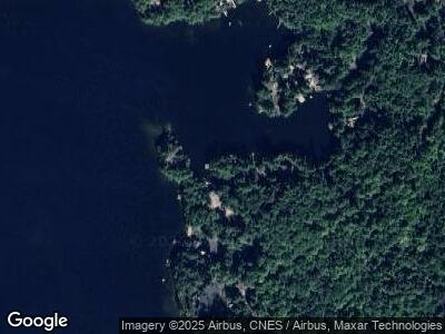
23 Tommys Cove Rd Meredith, NH 03253
Meredith NeighborhoodEstimated Value: $1,265,000 - $1,870,000
4
Beds
1
Bath
1,120
Sq Ft
$1,315/Sq Ft
Est. Value
About This Home
This home is located at 23 Tommys Cove Rd, Meredith, NH 03253 and is currently estimated at $1,472,398, approximately $1,314 per square foot. 23 Tommys Cove Rd is a home located in Belknap County with nearby schools including Inter-Lakes Elementary School, Sandwich Central School, and Inter-Lakes Middle High School.
Ownership History
Date
Name
Owned For
Owner Type
Purchase Details
Closed on
Jun 5, 2024
Sold by
Romary Ft and Romary
Bought by
M Jane Williamson Ret and Williamson
Current Estimated Value
Purchase Details
Closed on
May 25, 2018
Sold by
Windener Burton L and Ciriello Frances M
Bought by
Romery Thomas G and Romary Linda S
Home Financials for this Owner
Home Financials are based on the most recent Mortgage that was taken out on this home.
Original Mortgage
$572,000
Interest Rate
3.88%
Mortgage Type
Purchase Money Mortgage
Purchase Details
Closed on
Jul 2, 1992
Bought by
Widener Burton L and Ciriello Frances M
Create a Home Valuation Report for This Property
The Home Valuation Report is an in-depth analysis detailing your home's value as well as a comparison with similar homes in the area
Home Values in the Area
Average Home Value in this Area
Purchase History
| Date | Buyer | Sale Price | Title Company |
|---|---|---|---|
| M Jane Williamson Ret | $1,400,200 | None Available | |
| Romery Thomas G | $715,000 | -- | |
| Widener Burton L | $188,600 | -- |
Source: Public Records
Mortgage History
| Date | Status | Borrower | Loan Amount |
|---|---|---|---|
| Previous Owner | Romary Ft | $543,000 | |
| Previous Owner | Romery Thomas G | $572,000 |
Source: Public Records
Tax History Compared to Growth
Tax History
| Year | Tax Paid | Tax Assessment Tax Assessment Total Assessment is a certain percentage of the fair market value that is determined by local assessors to be the total taxable value of land and additions on the property. | Land | Improvement |
|---|---|---|---|---|
| 2024 | $14,334 | $1,397,100 | $1,303,600 | $93,500 |
| 2023 | $13,817 | $1,397,100 | $1,303,600 | $93,500 |
| 2022 | $10,447 | $747,800 | $669,000 | $78,800 |
| 2021 | $10,005 | $745,000 | $669,000 | $76,000 |
| 2020 | $10,445 | $745,000 | $669,000 | $76,000 |
| 2019 | $10,769 | $677,700 | $594,900 | $82,800 |
| 2018 | $10,586 | $677,700 | $594,900 | $82,800 |
| 2016 | $9,530 | $611,300 | $522,000 | $89,300 |
| 2015 | $9,292 | $611,300 | $522,000 | $89,300 |
| 2014 | $9,066 | $611,300 | $522,000 | $89,300 |
| 2013 | $8,809 | $611,300 | $522,000 | $89,300 |
Source: Public Records
Map
Nearby Homes
- 18 Chicadee Ln
- 85 Old Hubbard Rd
- 18 Lovejoy Ln
- 6 Bear Island
- 138 Summit Ave
- 39 Lake Country Rd
- 94 Lucerne Ave Unit 6
- 616 Scenic Rd Unit 405
- 36 Nestledown Dr Unit C
- 728 Scenic Rd Unit 210
- 252 Skyview Ln
- 276 Sterling Dr
- 16 Leisure Time Ln
- 256 Skyview Ln
- 279 Sterling Dr
- 272 Sterling Dr Unit 14.50
- 283 Sterling Dr Unit 14.42
- 266 Sterling Dr Unit 14.51
- 285 Sterling Dr Unit 14.43
- 287 Sterling Dr Unit 14.44
