
230 Peninger Rd Central Point, OR 97502
Estimated payment $3,589/month
Total Views
1,240
0.85
Acre
$653,400
Price per Acre
37,026
Sq Ft Lot
About This Lot
High exposure interchange site next to Shari's and La Quinta Inn & Suites. Owner want to land lease or build to suit for qualified tenant, based on $15/sq. ft. land value. Owners reserve the right to approve tenant and use. Owners have developed a site plan for a drive thru fast food use of the site. Would consider Sale.
Listing Agent
Pulver and Leever Real Estate Brokerage Phone: 541-773-5391 License #780200698
Property Details
Property Type
- Land
Est. Annual Taxes
- $5,882
Lot Details
- 0.85 Acre Lot
- Property is zoned C-4, C-4
Community Details
- No Home Owners Association
Listing and Financial Details
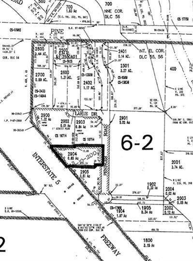
- Tax Lot 2904
- Assessor Parcel Number 10944133
Map
Create a Home Valuation Report for This Property
The Home Valuation Report is an in-depth analysis detailing your home's value as well as a comparison with similar homes in the area
Home Values in the Area
Average Home Value in this Area
Tax History
| Year | Tax Paid | Tax Assessment Tax Assessment Total Assessment is a certain percentage of the fair market value that is determined by local assessors to be the total taxable value of land and additions on the property. | Land | Improvement |
|---|---|---|---|---|
| 2024 | $5,882 | $343,490 | $343,490 | -- |
| 2023 | $5,693 | $333,490 | $333,490 | $0 |
| 2022 | $5,560 | $333,490 | $333,490 | $0 |
| 2021 | $5,401 | $323,780 | $323,780 | $0 |
| 2020 | $5,244 | $314,350 | $314,350 | $0 |
| 2019 | $5,114 | $296,320 | $296,320 | $0 |
| 2018 | $4,958 | $287,690 | $287,690 | $0 |
| 2017 | $4,832 | $287,690 | $287,690 | $0 |
| 2016 | $4,693 | $271,190 | $271,190 | $0 |
| 2015 | $4,496 | $271,190 | $271,190 | $0 |
| 2014 | $4,382 | $255,640 | $255,640 | $0 |
Source: Public Records
Property History
| Date | Event | Price | Change | Sq Ft Price |
|---|---|---|---|---|
| 02/27/2025 02/27/25 | For Sale | $555,390 | -- | -- |
Source: Southern Oregon MLS
Deed History
| Date | Type | Sale Price | Title Company |
|---|---|---|---|
| Warranty Deed | -- | None Available | |
| Interfamily Deed Transfer | -- | None Available |
Source: Public Records
Mortgage History
| Date | Status | Loan Amount | Loan Type |
|---|---|---|---|
| Closed | $75,000 | Unknown |
Source: Public Records
Similar Property in Central Point, OR
Source: Southern Oregon MLS
MLS Number: 220196464
APN: 10944133
Disclaimer: Certain information contained herein is derived from information provided by parties other than Homes.com. All information provided is deemed reliable, but is not guaranteed to be accurate and should be independently verified.
![]() © 2025 Oregon Datashare (KCAR | MLSCO | SOMLS). All rights reserved. The data relating to real estate for sale on this web site comes in part from the Internet Data Exchange Program of the Oregon Datashare. Real estate listings held by IDX Brokerage firms other than Ten-X are marked with the Internet Data Exchange logo or the Internet Data Exchange thumbnail logo and detailed information about them includes the name of the listing Brokers. Information provided is for consumers' personal, non-commercial use and may not be used for any purpose other than to identify prospective properties the viewer may be interested in purchasing. The consumer will not copy, retransmit nor redistribute any of the content from this website. Information provided is deemed reliable, but not guaranteed.
© 2025 Oregon Datashare (KCAR | MLSCO | SOMLS). All rights reserved. The data relating to real estate for sale on this web site comes in part from the Internet Data Exchange Program of the Oregon Datashare. Real estate listings held by IDX Brokerage firms other than Ten-X are marked with the Internet Data Exchange logo or the Internet Data Exchange thumbnail logo and detailed information about them includes the name of the listing Brokers. Information provided is for consumers' personal, non-commercial use and may not be used for any purpose other than to identify prospective properties the viewer may be interested in purchasing. The consumer will not copy, retransmit nor redistribute any of the content from this website. Information provided is deemed reliable, but not guaranteed.
Nearby Homes
- 1600 E Pine St
- 301 Freeman Rd Unit 7
- 1840 E Pine St
- 777 Columbine Way
- 885 Columbine Way
- 887 Columbine Way
- 340 Freeman Rd
- 555 Freeman Rd Unit 115
- 555 Freeman Rd Unit 15
- 555 Freeman Rd Unit 67
- 555 Freeman Rd Unit 61
- 1023 Brandi Way
- 4286 Hamrick Rd
- 2509 Brookdale Dr
- 531 Bush St
- 457 Rostel St
- 446 Beebe Rd
- 476 Grand Ave
- 2580 Parkwood Village Ln
- 1066 Glengrove Ave