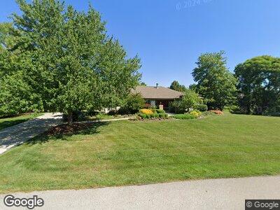
2332 Cove Point Ct Powell, OH 43065
Liberty-Deleware Co NeighborhoodEstimated Value: $730,000 - $799,000
3
Beds
2
Baths
2,694
Sq Ft
$280/Sq Ft
Est. Value
About This Home
This home is located at 2332 Cove Point Ct, Powell, OH 43065 and is currently estimated at $753,810, approximately $279 per square foot. 2332 Cove Point Ct is a home located in Delaware County with nearby schools including Tyler Run Elementary School, Olentangy Liberty Middle School, and Olentangy Liberty High School.
Ownership History
Date
Name
Owned For
Owner Type
Purchase Details
Closed on
Dec 28, 2023
Sold by
Ullery Maxwell Beth
Bought by
Kenton And Benita Lee Family Revocable Living and Lee
Current Estimated Value
Purchase Details
Closed on
Jun 7, 2023
Bought by
Beth Ullery Maxwell
Home Financials for this Owner
Home Financials are based on the most recent Mortgage that was taken out on this home.
Interest Rate
6.79%
Purchase Details
Closed on
Jun 12, 1998
Sold by
Baning Wilbur A
Bought by
Maxwell Donald C and Ullery Beth
Home Financials for this Owner
Home Financials are based on the most recent Mortgage that was taken out on this home.
Original Mortgage
$164,000
Interest Rate
7.32%
Mortgage Type
New Conventional
Create a Home Valuation Report for This Property
The Home Valuation Report is an in-depth analysis detailing your home's value as well as a comparison with similar homes in the area
Home Values in the Area
Average Home Value in this Area
Purchase History
| Date | Buyer | Sale Price | Title Company |
|---|---|---|---|
| Kenton And Benita Lee Family Revocable Living | $710,000 | Clearoak Settlement | |
| Beth Ullery Maxwell | -- | -- | |
| Maxwell Donald C | $364,000 | -- |
Source: Public Records
Mortgage History
| Date | Status | Borrower | Loan Amount |
|---|---|---|---|
| Previous Owner | Beth Ullery Maxwell | -- | |
| Previous Owner | Maxwell Donald C | $200,000 | |
| Previous Owner | Maxwell Donald C | $100,000 | |
| Previous Owner | Maxwell Donald C | $164,000 |
Source: Public Records
Tax History Compared to Growth
Tax History
| Year | Tax Paid | Tax Assessment Tax Assessment Total Assessment is a certain percentage of the fair market value that is determined by local assessors to be the total taxable value of land and additions on the property. | Land | Improvement |
|---|---|---|---|---|
| 2024 | $12,243 | $233,660 | $50,820 | $182,840 |
| 2023 | $11,808 | $233,660 | $50,820 | $182,840 |
| 2022 | $10,296 | $163,940 | $34,650 | $129,290 |
| 2021 | $10,359 | $163,940 | $34,650 | $129,290 |
| 2020 | $10,409 | $163,940 | $34,650 | $129,290 |
| 2019 | $8,656 | $143,290 | $34,650 | $108,640 |
| 2018 | $8,696 | $143,290 | $34,650 | $108,640 |
| 2017 | $8,605 | $134,190 | $33,600 | $100,590 |
| 2016 | $8,630 | $134,190 | $33,600 | $100,590 |
| 2015 | $7,805 | $134,190 | $33,600 | $100,590 |
| 2014 | $7,912 | $134,190 | $33,600 | $100,590 |
| 2013 | $8,096 | $134,190 | $33,600 | $100,590 |
Source: Public Records
Map
Nearby Homes
- 8796 Seabright Dr
- 2008 Edmunds Ct
- 1525 Picardae Ct
- 8779 Yates Point Ct
- 1643 Villa Way
- 1502 Markland St
- 1546 Oakview Dr
- 1937 Liberty St
- 2105 Liberty St
- 1336 Hickory Ridge Ln
- 10200 Abbottshire Village Place
- 197 Donerail Ave
- 126 Cressingham Ln
- 8470 Seabright Dr
- 1379 Red Bud Ct
- 204 Olentangy Ridge Place
- 201 Tiller Dr
- 1462 Dogwood Loop
- 1474 Dogwood Loop
- 1480 Dogwood Loop