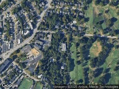
2345 Bedford Ave Unit 1B Cincinnati, OH 45208
Hyde Park NeighborhoodEstimated Value: $604,000 - $1,094,647
2
Beds
3
Baths
2,455
Sq Ft
$357/Sq Ft
Est. Value
About This Home
This home is located at 2345 Bedford Ave Unit 1B, Cincinnati, OH 45208 and is currently estimated at $877,216, approximately $357 per square foot. 2345 Bedford Ave Unit 1B is a home located in Hamilton County with nearby schools including Withrow University High School, Clark Montessori High School, and Shroder High School.
Ownership History
Date
Name
Owned For
Owner Type
Purchase Details
Closed on
Jun 18, 2020
Sold by
Lawarre William and Lawarre Claudia
Bought by
Reister Ellen G
Current Estimated Value
Purchase Details
Closed on
Dec 31, 2019
Sold by
Callard Linda S and Linda S Callard Qualified Pers
Bought by
Lawarre William and Lawarre Claudia
Purchase Details
Closed on
Dec 18, 2013
Sold by
Callard Linda S and Callard George M
Bought by
Callard Linda S and Linda S Callard Qualified Personal Resid
Purchase Details
Closed on
May 29, 2012
Sold by
Callard George M and Callard Linda S
Bought by
Callard George M and George M Callard Trust
Purchase Details
Closed on
Sep 1, 1998
Sold by
Bennie Daniel M
Bought by
Callard George M and Callard Linda S
Purchase Details
Closed on
Aug 31, 1998
Sold by
Blaine Charlee B
Bought by
Bennie Daniel M
Create a Home Valuation Report for This Property
The Home Valuation Report is an in-depth analysis detailing your home's value as well as a comparison with similar homes in the area
Home Values in the Area
Average Home Value in this Area
Purchase History
| Date | Buyer | Sale Price | Title Company |
|---|---|---|---|
| Reister Ellen G | $850,000 | None Available | |
| Lawarre William | $725,000 | Mission Title Llc | |
| Callard Linda S | -- | Attorney | |
| Callard Linda S | -- | Attorney | |
| Callard George M | -- | Attorney | |
| Callard George M | -- | Attorney | |
| Callard George M | -- | -- | |
| Bennie Daniel M | $400,000 | -- |
Source: Public Records
Tax History Compared to Growth
Tax History
| Year | Tax Paid | Tax Assessment Tax Assessment Total Assessment is a certain percentage of the fair market value that is determined by local assessors to be the total taxable value of land and additions on the property. | Land | Improvement |
|---|---|---|---|---|
| 2024 | $17,957 | $301,315 | $33,250 | $268,065 |
| 2023 | $18,363 | $301,315 | $33,250 | $268,065 |
| 2022 | $20,210 | $297,500 | $29,988 | $267,512 |
| 2021 | $19,463 | $297,500 | $29,988 | $267,512 |
| 2020 | $19,442 | $297,500 | $29,988 | $267,512 |
| 2019 | $11,112 | $159,761 | $22,050 | $137,711 |
| 2018 | $11,129 | $159,761 | $22,050 | $137,711 |
| 2017 | $10,565 | $159,761 | $22,050 | $137,711 |
| 2016 | $10,127 | $151,585 | $21,973 | $129,612 |
| 2015 | $9,135 | $151,585 | $21,973 | $129,612 |
| 2014 | $9,202 | $151,585 | $21,973 | $129,612 |
| 2013 | $10,112 | $162,992 | $23,625 | $139,367 |
Source: Public Records
Map
Nearby Homes
- 3012 Paul St
- 1/2 Lavinia Ave
- 3048 O Bryon St
- 2324 Madison Rd
- 1906 Pogue Ave
- 2370 Madison Rd
- 2030 Hewitt Ave
- 1949 Kinney Ave
- 2320 Dana Ave Unit 2320
- 2356 Dana Ave Unit 2356
- 2292 Dana Ave
- 3414 Bevis Ave
- 1910 Kinney Ave
- 3543 Vista Ave
- 2461 Grandin Rd
- 2526 Riverside Dr
- 1922 Hewitt Ave
- 2197 Crane Ave
- 2734 Hoff Ave
- 2485 Riverside Dr
