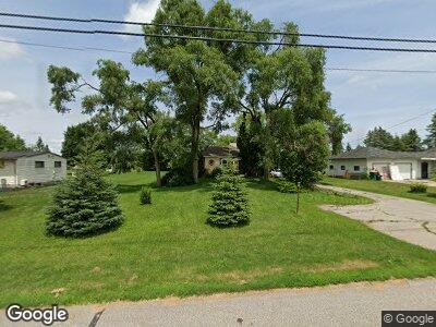
2433 Midland Rd Bay City, MI 48706
Estimated Value: $124,000 - $175,000
2
Beds
1
Bath
1,064
Sq Ft
$134/Sq Ft
Est. Value
About This Home
This home is located at 2433 Midland Rd, Bay City, MI 48706 and is currently estimated at $143,077, approximately $134 per square foot. 2433 Midland Rd is a home located in Bay County with nearby schools including McAlear-Sawden Elementary School, Western Middle School, and Bay City Western High School.
Ownership History
Date
Name
Owned For
Owner Type
Purchase Details
Closed on
Jan 12, 2024
Sold by
Wells Fargo Bank Na
Bought by
Shanks Kyle Jennings and Shanks Charles Allan
Current Estimated Value
Purchase Details
Closed on
Dec 16, 2022
Sold by
Sheriff Of Bay County
Bought by
Wells Fargo Bank Na
Purchase Details
Closed on
Jan 24, 2012
Sold by
Packard Julie Ann and Heintskill Julie Ann
Bought by
Heintskill Daniel Edward
Purchase Details
Closed on
Dec 22, 2004
Sold by
Monville Jacqueline Ann
Bought by
Heintskill Daniel E
Home Financials for this Owner
Home Financials are based on the most recent Mortgage that was taken out on this home.
Original Mortgage
$88,100
Interest Rate
7.2%
Mortgage Type
Purchase Money Mortgage
Create a Home Valuation Report for This Property
The Home Valuation Report is an in-depth analysis detailing your home's value as well as a comparison with similar homes in the area
Home Values in the Area
Average Home Value in this Area
Purchase History
| Date | Buyer | Sale Price | Title Company |
|---|---|---|---|
| Shanks Kyle Jennings | $77,000 | None Listed On Document | |
| Wells Fargo Bank Na | $77,382 | -- | |
| Heintskill Daniel Edward | -- | None Available | |
| Heintskill Daniel E | $88,100 | -- |
Source: Public Records
Mortgage History
| Date | Status | Borrower | Loan Amount |
|---|---|---|---|
| Previous Owner | Heintskill Daniel | $84,688 | |
| Previous Owner | Heintskill Daniel E | $91,380 | |
| Previous Owner | Heintskill Daniel E | $88,100 |
Source: Public Records
Tax History Compared to Growth
Tax History
| Year | Tax Paid | Tax Assessment Tax Assessment Total Assessment is a certain percentage of the fair market value that is determined by local assessors to be the total taxable value of land and additions on the property. | Land | Improvement |
|---|---|---|---|---|
| 2024 | $818 | $55,600 | $0 | $0 |
| 2023 | $484 | $51,000 | $0 | $0 |
| 2022 | $1,274 | $49,700 | $0 | $0 |
| 2021 | $1,201 | $43,300 | $43,300 | $0 |
| 2020 | $1,197 | $39,700 | $39,700 | $0 |
| 2019 | $1,141 | $38,600 | $0 | $0 |
| 2018 | $1,101 | $37,700 | $0 | $0 |
| 2017 | $1,024 | $36,500 | $0 | $0 |
| 2016 | $1,026 | $35,700 | $0 | $35,700 |
| 2015 | $406 | $32,700 | $0 | $32,700 |
| 2014 | $406 | $32,800 | $0 | $32,800 |
Source: Public Records
Map
Nearby Homes
- 2415 Midland Rd
- 2328 Midland Rd
- 0 Midland Rd Unit 50150918
- 2289 Holly Ridge Ln
- 4522 E Crossroads Dr
- 4758 Pine View Ct
- 1948 Midland Rd
- 0 S Two Mile Rd Unit 50142051
- 0 2 Mile Rd Unit 50169642
- 2895 Queen Annes Ct
- 3060 Kessler Dr
- 2913 Pepperberry Dr
- 1743 Midland Rd
- 5098 Oakhurst Ct
- 3196 Haberland Dr
- 0 E Salzburg Rd
- 2294 E Salzburg Rd
- 12 Cove Dr
- 14 Cove Dr
- 16 Cove Dr