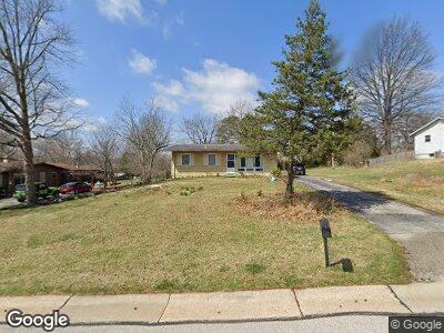
245 E Skyline Dr Ballwin, MO 63011
Estimated Value: $224,535 - $248,000
3
Beds
1
Bath
925
Sq Ft
$252/Sq Ft
Est. Value
About This Home
This home is located at 245 E Skyline Dr, Ballwin, MO 63011 and is currently estimated at $233,384, approximately $252 per square foot. 245 E Skyline Dr is a home located in St. Louis County with nearby schools including Westridge Elementary School, Crestview Middle School, and Marquette Sr. High School.
Ownership History
Date
Name
Owned For
Owner Type
Purchase Details
Closed on
Apr 25, 2008
Sold by
Feist William
Bought by
Leschen Shawn D
Current Estimated Value
Home Financials for this Owner
Home Financials are based on the most recent Mortgage that was taken out on this home.
Original Mortgage
$118,000
Interest Rate
5.84%
Mortgage Type
Purchase Money Mortgage
Purchase Details
Closed on
Feb 27, 1998
Sold by
Viola Moore Ruth
Bought by
Feist William
Home Financials for this Owner
Home Financials are based on the most recent Mortgage that was taken out on this home.
Original Mortgage
$75,600
Interest Rate
7.08%
Create a Home Valuation Report for This Property
The Home Valuation Report is an in-depth analysis detailing your home's value as well as a comparison with similar homes in the area
Home Values in the Area
Average Home Value in this Area
Purchase History
| Date | Buyer | Sale Price | Title Company |
|---|---|---|---|
| Leschen Shawn D | $147,500 | None Available | |
| Feist William | -- | -- | |
| Moore Viola Ruth | -- | -- |
Source: Public Records
Mortgage History
| Date | Status | Borrower | Loan Amount |
|---|---|---|---|
| Open | Leschen Shawn | $55,000 | |
| Open | Leschen Shawn D | $115,500 | |
| Closed | Leschen Shawn D | $118,000 | |
| Previous Owner | Feist William | $75,600 |
Source: Public Records
Tax History Compared to Growth
Tax History
| Year | Tax Paid | Tax Assessment Tax Assessment Total Assessment is a certain percentage of the fair market value that is determined by local assessors to be the total taxable value of land and additions on the property. | Land | Improvement |
|---|---|---|---|---|
| 2023 | $2,458 | $34,980 | $21,380 | $13,600 |
| 2022 | $2,255 | $29,770 | $23,520 | $6,250 |
| 2021 | $2,239 | $29,770 | $23,520 | $6,250 |
| 2020 | $2,193 | $27,800 | $17,860 | $9,940 |
| 2019 | $2,202 | $27,800 | $17,860 | $9,940 |
| 2018 | $2,046 | $24,340 | $14,060 | $10,280 |
| 2017 | $1,998 | $24,340 | $14,060 | $10,280 |
| 2016 | $1,682 | $19,650 | $9,960 | $9,690 |
| 2015 | $1,648 | $19,650 | $9,960 | $9,690 |
| 2014 | $1,829 | $21,300 | $8,210 | $13,090 |
Source: Public Records
Map
Nearby Homes
- 609 Log Hill Ct
- 847 Portsdown Rd
- 160 Cumberland Park Ct Unit G
- 115 Vlasis Dr
- 322 Sudbury Ln
- 930 Crestland Dr
- 128 White Tree Ln
- 344 Sudbury Ln
- 150 Steamboat Ln
- 273 White Tree Ln
- 238 Pointe Lucerne Ct
- 205 Mar el Ct
- 443 Clayheath Ct
- 709 Redstart Dr
- 348 Providence Rd
- 15248 Clayton Rd
- 248 Leichester Cir
- 517 Wellshire Ct
- 580 Windsor Mill Dr
- 218 Spooners Mill Dr