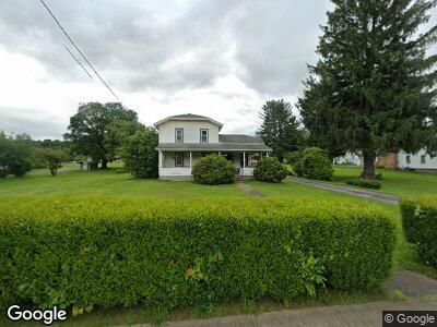
246 W Main St Youngsville, PA 16371
Estimated Value: $87,935 - $126,000
3
Beds
1
Bath
1,616
Sq Ft
$62/Sq Ft
Est. Value
About This Home
This home is located at 246 W Main St, Youngsville, PA 16371 and is currently estimated at $99,984, approximately $61 per square foot. 246 W Main St is a home located in Warren County with nearby schools including Youngsville Elementary/Middle School, Youngsville High School, and Warren County Christian School.
Ownership History
Date
Name
Owned For
Owner Type
Purchase Details
Closed on
Dec 7, 2023
Sold by
Armstrong David L and Chriscaden Yvonne A
Bought by
Rieder Jocelyn N
Current Estimated Value
Home Financials for this Owner
Home Financials are based on the most recent Mortgage that was taken out on this home.
Original Mortgage
$97,000
Outstanding Balance
$96,068
Interest Rate
7.29%
Mortgage Type
New Conventional
Estimated Equity
$13,343
Purchase Details
Closed on
Nov 4, 2005
Bought by
Chriscaden Patricia M
Create a Home Valuation Report for This Property
The Home Valuation Report is an in-depth analysis detailing your home's value as well as a comparison with similar homes in the area
Home Values in the Area
Average Home Value in this Area
Purchase History
| Date | Buyer | Sale Price | Title Company |
|---|---|---|---|
| Rieder Jocelyn N | $100,000 | None Listed On Document | |
| Chriscaden Patricia M | $60,000 | -- |
Source: Public Records
Mortgage History
| Date | Status | Borrower | Loan Amount |
|---|---|---|---|
| Open | Rieder Jocelyn N | $97,000 |
Source: Public Records
Tax History Compared to Growth
Tax History
| Year | Tax Paid | Tax Assessment Tax Assessment Total Assessment is a certain percentage of the fair market value that is determined by local assessors to be the total taxable value of land and additions on the property. | Land | Improvement |
|---|---|---|---|---|
| 2024 | $1,449 | $15,995 | $2,641 | $13,354 |
| 2023 | $1,032 | $15,995 | $2,641 | $13,354 |
| 2022 | $1,385 | $15,995 | $2,641 | $13,354 |
| 2021 | $1,377 | $15,995 | $2,641 | $13,354 |
| 2020 | $1,377 | $15,995 | $2,641 | $13,354 |
| 2019 | $1,493 | $15,995 | $2,641 | $13,354 |
| 2018 | $1,373 | $15,995 | $2,641 | $13,354 |
| 2017 | $1,343 | $15,995 | $2,641 | $13,354 |
| 2016 | $1,311 | $15,995 | $0 | $0 |
| 2015 | -- | $15,995 | $0 | $0 |
| 2014 | -- | $15,995 | $0 | $0 |
| 2013 | -- | $15,995 | $2,641 | $13,354 |
Source: Public Records
Map
Nearby Homes
- 0 High St
- 516 N Main St
- 325 College St
- 566 College St
- 81 Hickory Hill Ln
- 28952 U S 6
- 1347 Mead Run Rd
- 381 Abraham Hollow Rd
- 30 Carriage Dr
- 1151 Hull Hill Rd
- 1440 Abraham Hollow Rd
- 1694 Abraham Hollow Rd
- 56 Apple Ln
- 996 National Forge Rd
- 212 Main St
- 355 Main St
- 1683 Dunns Eddy Rd
- 2660 U S 62
- 0 Grass Flats Blvd Unit 13552
- 33710 Route 6