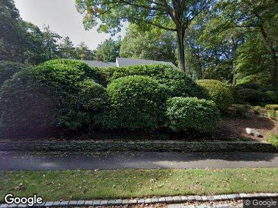
25 Autumn Rd Weston, MA 02493
Estimated Value: $2,597,870 - $3,336,000
5
Beds
5
Baths
4,014
Sq Ft
$717/Sq Ft
Est. Value
About This Home
This home is located at 25 Autumn Rd, Weston, MA 02493 and is currently estimated at $2,876,968, approximately $716 per square foot. 25 Autumn Rd is a home located in Middlesex County with nearby schools including Country Elementary School, Woodland Elementary School, and Field Elementary School.
Ownership History
Date
Name
Owned For
Owner Type
Purchase Details
Closed on
May 17, 2013
Sold by
Autumn 25 Rt
Bought by
Rose Lisa D and Rose Alan D
Current Estimated Value
Home Financials for this Owner
Home Financials are based on the most recent Mortgage that was taken out on this home.
Original Mortgage
$700,000
Interest Rate
3.57%
Mortgage Type
Purchase Money Mortgage
Create a Home Valuation Report for This Property
The Home Valuation Report is an in-depth analysis detailing your home's value as well as a comparison with similar homes in the area
Home Values in the Area
Average Home Value in this Area
Purchase History
| Date | Buyer | Sale Price | Title Company |
|---|---|---|---|
| Rose Lisa D | $1,000,000 | -- |
Source: Public Records
Mortgage History
| Date | Status | Borrower | Loan Amount |
|---|---|---|---|
| Open | Rose Alan D | $700,000 | |
| Closed | Rose Alan D | $940,000 | |
| Closed | Rose Alan D | $450,000 | |
| Closed | Rose Alan D | $300,000 | |
| Closed | Rose Alan D | $300,000 | |
| Closed | Rose Lisa D | $700,000 | |
| Previous Owner | Donahue Ruth M | $1,190,000 | |
| Previous Owner | Donahue Ruth M | $500,000 | |
| Previous Owner | Donahue Ruth M | $450,000 |
Source: Public Records
Tax History Compared to Growth
Tax History
| Year | Tax Paid | Tax Assessment Tax Assessment Total Assessment is a certain percentage of the fair market value that is determined by local assessors to be the total taxable value of land and additions on the property. | Land | Improvement |
|---|---|---|---|---|
| 2025 | $27,586 | $2,485,200 | $998,700 | $1,486,500 |
| 2024 | $26,965 | $2,424,900 | $998,700 | $1,426,200 |
| 2023 | $26,963 | $2,277,300 | $998,700 | $1,278,600 |
| 2022 | $25,630 | $2,000,800 | $953,600 | $1,047,200 |
| 2021 | $24,755 | $1,907,200 | $906,200 | $1,001,000 |
| 2020 | $6,975 | $1,852,900 | $906,200 | $946,700 |
| 2019 | $6,293 | $1,834,600 | $906,200 | $928,400 |
| 2018 | $5,974 | $1,834,600 | $906,200 | $928,400 |
| 2017 | $5,915 | $1,771,300 | $906,200 | $865,100 |
| 2016 | $21,539 | $1,771,300 | $906,200 | $865,100 |
| 2015 | $20,964 | $1,707,200 | $864,800 | $842,400 |
Source: Public Records
Map
Nearby Homes
- 217 Summer St
- 80 Loring Rd
- 56 Doublet Hill Rd
- 12 Robin Rd
- 4 Prescott Ln
- 707 South St
- 48 Albert St
- 75 Cart Path Rd
- 70 Possum Rd
- 243 Islington Rd
- 43 Angleside Rd Unit 4
- 131 Newton St
- 110 Robin Rd
- 25 Duffield Rd
- 85 Kingswood Rd
- 75 Bourne St Unit 75
- 21 Edgewater Park
- 154 Newton St
- 6 Charles St Unit 6
- 7 Johnson Place Unit 7