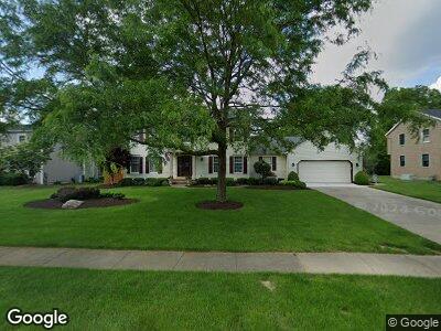
2515 Cardigan Dr Akron, OH 44333
Fairlawn NeighborhoodEstimated Value: $421,431 - $484,000
4
Beds
3
Baths
2,632
Sq Ft
$177/Sq Ft
Est. Value
About This Home
This home is located at 2515 Cardigan Dr, Akron, OH 44333 and is currently estimated at $466,108, approximately $177 per square foot. 2515 Cardigan Dr is a home located in Summit County with nearby schools including Richfield Elementary School, Bath Elementary School, and Revere Middle School.
Ownership History
Date
Name
Owned For
Owner Type
Purchase Details
Closed on
Apr 5, 2019
Sold by
Smith Eric W and Smith Susan V
Bought by
Smith Eric W and Smith Susan V
Current Estimated Value
Purchase Details
Closed on
Apr 1, 2011
Sold by
Smith Eric W and Smith Susan V
Bought by
Smith Eric W and Smith Susan V
Purchase Details
Closed on
Oct 3, 2010
Sold by
Smith Eric W and Smith Susan V
Bought by
Smith Eric W and Smith Susan V
Purchase Details
Closed on
Nov 2, 2007
Sold by
Smith Eric W and Smith Susan V
Bought by
Smith Eric W and Smith Susan V
Purchase Details
Closed on
Jul 15, 1999
Sold by
Smith Eric W and Smith Susan V
Bought by
Smith Eric W and Smith Susan V
Create a Home Valuation Report for This Property
The Home Valuation Report is an in-depth analysis detailing your home's value as well as a comparison with similar homes in the area
Home Values in the Area
Average Home Value in this Area
Purchase History
| Date | Buyer | Sale Price | Title Company |
|---|---|---|---|
| Smith Eric W | -- | None Available | |
| Smith Eric W | -- | None Available | |
| Smith Eric W | -- | None Available | |
| Smith Eric W | -- | Attorney | |
| Smith Eric W | -- | -- |
Source: Public Records
Mortgage History
| Date | Status | Borrower | Loan Amount |
|---|---|---|---|
| Closed | Smith Eric W | $110,000 | |
| Closed | Smith Eric W | $75,000 | |
| Closed | Smith Eric W | $92,771 | |
| Closed | Smith Eric W | $157,843 | |
| Closed | Smith Eric | $165,000 | |
| Closed | Smith Eric W | $53,600 |
Source: Public Records
Tax History Compared to Growth
Tax History
| Year | Tax Paid | Tax Assessment Tax Assessment Total Assessment is a certain percentage of the fair market value that is determined by local assessors to be the total taxable value of land and additions on the property. | Land | Improvement |
|---|---|---|---|---|
| 2025 | $6,255 | $122,697 | $21,613 | $101,084 |
| 2024 | $6,255 | $122,697 | $21,613 | $101,084 |
| 2023 | $6,255 | $122,697 | $21,613 | $101,084 |
| 2022 | $5,436 | $95,029 | $16,625 | $78,404 |
| 2021 | $5,170 | $90,269 | $16,625 | $73,644 |
| 2020 | $5,066 | $90,270 | $16,630 | $73,640 |
| 2019 | $5,223 | $88,160 | $17,620 | $70,540 |
| 2018 | $5,161 | $88,160 | $17,620 | $70,540 |
| 2017 | $4,328 | $88,160 | $17,620 | $70,540 |
| 2016 | $4,503 | $72,630 | $15,960 | $56,670 |
| 2015 | $4,328 | $72,630 | $15,960 | $56,670 |
| 2014 | $4,302 | $72,630 | $15,960 | $56,670 |
| 2013 | $4,174 | $71,150 | $15,960 | $55,190 |
Source: Public Records
Map
Nearby Homes
- 2410 Balmoral Dr
- 702 N Revere Rd
- 2761 Rising Meadow Dr
- 1911 Brookwood Dr Unit G1911
- 1941 Brookwood Dr
- 721 Winding Way
- 1078 Hampton Ridge Dr
- 1716 Brookwood Dr
- 565 Hampton Ridge Dr Unit MM565
- 1999 E Woodland Dr
- 1988 E Woodland Dr
- 1779 Bent Bow Dr
- 764 Hampton Ridge Dr
- 2893 Burr Oak Dr
- 2674 Smith Rd
- 301 Owosso Ave
- 491 Parkside Dr
- 287 Overwood Rd
- 1570 Shade Rd
- 260 Sand Run Rd