--
Bed
--
Bath
--
Sq Ft
19
Acres
About This Home
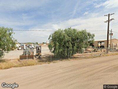
This home is located at 2555 N Center St, Mesa, AZ 85201. 2555 N Center St is a home located in Maricopa County with nearby schools including Lehi Elementary School, Franklin at Brimhall Elementary School, and Franklin West Elementary School.
Ownership History
Date
Name
Owned For
Owner Type
Purchase Details
Closed on
Apr 14, 2023
Sold by
Marklor Llc
Bought by
Center Street Dirt Llc
Home Financials for this Owner
Home Financials are based on the most recent Mortgage that was taken out on this home.
Original Mortgage
$6,500,000
Outstanding Balance
$6,366,866
Interest Rate
6.65%
Mortgage Type
Seller Take Back
Purchase Details
Closed on
Nov 1, 2005
Sold by
Lehi Properties Llc
Bought by
Marklor Llc
Home Financials for this Owner
Home Financials are based on the most recent Mortgage that was taken out on this home.
Original Mortgage
$2,600,000
Interest Rate
5.74%
Mortgage Type
Seller Take Back
Purchase Details
Closed on
Dec 29, 2003
Sold by
Calmat Co
Bought by
Lehi Properties Llc
Home Financials for this Owner
Home Financials are based on the most recent Mortgage that was taken out on this home.
Original Mortgage
$1,423,000
Interest Rate
6.03%
Mortgage Type
Seller Take Back
Create a Home Valuation Report for This Property
The Home Valuation Report is an in-depth analysis detailing your home's value as well as a comparison with similar homes in the area
Home Values in the Area
Average Home Value in this Area
Purchase History
| Date | Buyer | Sale Price | Title Company |
|---|---|---|---|
| Center Street Dirt Llc | $8,500,000 | Empire Title Agency | |
| Marklor Llc | $4,600,000 | -- | |
| Lehi Properties Llc | $2,000,000 | First American Title |
Source: Public Records
Mortgage History
| Date | Status | Borrower | Loan Amount |
|---|---|---|---|
| Open | Center Street Dirt Llc | $6,500,000 | |
| Previous Owner | Marklor Llc | $1,000,000 | |
| Previous Owner | Marklor Llc | $2,300,000 | |
| Previous Owner | Marklor Llc | $2,600,000 | |
| Previous Owner | Lehi Properties Llc | $1,423,000 | |
| Closed | Lehi Properties Llc | $327,000 |
Source: Public Records
Tax History Compared to Growth
Tax History
| Year | Tax Paid | Tax Assessment Tax Assessment Total Assessment is a certain percentage of the fair market value that is determined by local assessors to be the total taxable value of land and additions on the property. | Land | Improvement |
|---|---|---|---|---|
| 2025 | $6,343 | $59,680 | $59,680 | -- |
| 2024 | $6,918 | $61,545 | $61,545 | -- |
| 2023 | $6,918 | $63,410 | $63,410 | $0 |
| 2022 | $7,323 | $65,275 | $65,275 | $0 |
| 2021 | $8,006 | $67,140 | $67,140 | $0 |
| 2020 | $8,296 | $67,140 | $67,140 | $0 |
| 2019 | $8,139 | $67,140 | $67,140 | $0 |
| 2018 | $8,136 | $67,140 | $67,140 | $0 |
| 2017 | $7,894 | $67,140 | $67,140 | $0 |
| 2016 | $7,747 | $67,140 | $67,140 | $0 |
| 2015 | $7,484 | $59,132 | $59,132 | $0 |
Source: Public Records
Map
Nearby Homes
- 424 E Lehi Rd
- 2121 N Center St Unit 141
- 2121 N Center St Unit 119
- 2121 N Center St Unit 5
- 2121 N Center St Unit 86
- 2121 N Center St Unit 151
- 2121 N Center St Unit 51
- 521 E Lehi Rd
- 320 E Mckellips Rd Unit 166
- 320 E Mckellips Rd Unit 227
- 320 E Mckellips Rd Unit 195
- 320 E Mckellips Rd Unit 44
- 320 E Mckellips Rd Unit 46
- 320 E Mckellips Rd Unit 34
- 320 E Mckellips Rd Unit 25
- 2145 N Silverton St
- 1950 N Center St Unit 141
- 1950 N Center St Unit 101
- 1950 N Center St Unit 104
- 2132 N Silverton St Unit 43