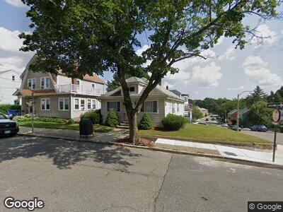
256 Manchester St Mattapan, MA 02126
Southern Mattapan NeighborhoodEstimated Value: $614,529 - $636,000
4
Beds
2
Baths
1,554
Sq Ft
$402/Sq Ft
Est. Value
About This Home
This home is located at 256 Manchester St, Mattapan, MA 02126 and is currently estimated at $624,382, approximately $401 per square foot. 256 Manchester St is a home located in Suffolk County with nearby schools including Conservatory Lab Upper School and Saint John Paul II Catholic Academy.
Ownership History
Date
Name
Owned For
Owner Type
Purchase Details
Closed on
Oct 21, 2009
Sold by
Raymond J Johnson Rt
Bought by
Johnson Raymond J
Current Estimated Value
Purchase Details
Closed on
Feb 14, 2008
Sold by
Johnson Raymond J
Bought by
Raymond J Johnson Rt
Home Financials for this Owner
Home Financials are based on the most recent Mortgage that was taken out on this home.
Original Mortgage
$160,000
Interest Rate
6.3%
Purchase Details
Closed on
Nov 14, 2007
Sold by
256 Manchester St Rt
Bought by
Johnson Katherine A
Home Financials for this Owner
Home Financials are based on the most recent Mortgage that was taken out on this home.
Original Mortgage
$160,000
Interest Rate
6.3%
Purchase Details
Closed on
Nov 24, 2004
Sold by
Johnson James E Est
Bought by
Manchester St Rt
Create a Home Valuation Report for This Property
The Home Valuation Report is an in-depth analysis detailing your home's value as well as a comparison with similar homes in the area
Home Values in the Area
Average Home Value in this Area
Purchase History
| Date | Buyer | Sale Price | Title Company |
|---|---|---|---|
| Johnson Raymond J | -- | -- | |
| Raymond J Johnson Rt | -- | -- | |
| Gouzoule Catherine A | -- | -- | |
| Johnson Katherine A | -- | -- | |
| Manchester St Rt | -- | -- |
Source: Public Records
Mortgage History
| Date | Status | Borrower | Loan Amount |
|---|---|---|---|
| Previous Owner | Johnson Katherine A | $160,000 | |
| Previous Owner | Johnson James E | $20,000 | |
| Previous Owner | Johnson James E | $83,000 | |
| Previous Owner | Johnson James E | $37,006 |
Source: Public Records
Tax History Compared to Growth
Tax History
| Year | Tax Paid | Tax Assessment Tax Assessment Total Assessment is a certain percentage of the fair market value that is determined by local assessors to be the total taxable value of land and additions on the property. | Land | Improvement |
|---|---|---|---|---|
| 2025 | $5,651 | $488,000 | $164,400 | $323,600 |
| 2024 | $5,499 | $504,500 | $169,100 | $335,400 |
| 2023 | $5,457 | $508,100 | $162,600 | $345,500 |
| 2022 | $5,119 | $470,500 | $150,600 | $319,900 |
| 2021 | $4,962 | $465,000 | $150,600 | $314,400 |
| 2020 | $4,684 | $443,600 | $153,900 | $289,700 |
| 2019 | $4,324 | $410,200 | $124,200 | $286,000 |
| 2018 | $4,095 | $390,700 | $124,200 | $266,500 |
| 2017 | $3,903 | $368,600 | $124,200 | $244,400 |
| 2016 | $3,754 | $341,300 | $124,200 | $217,100 |
| 2015 | $3,746 | $309,300 | $108,000 | $201,300 |
| 2014 | $3,633 | $288,800 | $108,000 | $180,800 |
Source: Public Records
Map
Nearby Homes
- 19 Standard St Unit 2
- 23-27 Cedar St Unit 1
- 60 Sanford St
- 14 Caddy Rd
- 6 Newcroft Cir
- 51 River St
- 131 Eliot St Unit 102
- 97 Saint Gregory St
- 172 Fairmount St Unit 2
- 107 Central Ave
- 30 Pleasant Hill Ave Unit 32
- 10 Briarcliff Terrace
- 84-86 Codman Hill Ave
- 3 River Street Place
- 1241-1251 Adams St Unit F608
- 1241-1255 Adams St Unit B202
- 17 Richmond St Unit 1
- 44-46 Codman Hill Ave
- 1245 Adams St Unit B409
- 25 Driscoll Dr