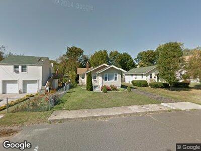
259 Allen Place Long Branch, NJ 07740
Estimated Value: $464,000 - $947,000
2
Beds
1
Bath
1,318
Sq Ft
$478/Sq Ft
Est. Value
About This Home
This home is located at 259 Allen Place, Long Branch, NJ 07740 and is currently estimated at $630,621, approximately $478 per square foot. 259 Allen Place is a home located in Monmouth County with nearby schools including Long Branch High School and Holy Trinity School.
Ownership History
Date
Name
Owned For
Owner Type
Purchase Details
Closed on
Nov 21, 2022
Sold by
Vieira Mario R and Vieira Linda
Bought by
Zafarani Sandra
Current Estimated Value
Purchase Details
Closed on
Dec 15, 2011
Sold by
Federal National Mortgage Association
Bought by
Vieira Mario R and Vieira Linda
Purchase Details
Closed on
Jan 11, 2011
Sold by
Sanderson Robert and Sanderson Theresa
Bought by
Federal National Mortgage Association
Create a Home Valuation Report for This Property
The Home Valuation Report is an in-depth analysis detailing your home's value as well as a comparison with similar homes in the area
Home Values in the Area
Average Home Value in this Area
Purchase History
| Date | Buyer | Sale Price | Title Company |
|---|---|---|---|
| Zafarani Sandra | $900,000 | Fidelity National Title | |
| Vieira Mario R | $98,000 | Old Republic National Title | |
| Federal National Mortgage Association | -- | None Available |
Source: Public Records
Mortgage History
| Date | Status | Borrower | Loan Amount |
|---|---|---|---|
| Previous Owner | Sanderson Robert | $196,617 | |
| Previous Owner | Sanderson Robert | $165,000 |
Source: Public Records
Tax History Compared to Growth
Tax History
| Year | Tax Paid | Tax Assessment Tax Assessment Total Assessment is a certain percentage of the fair market value that is determined by local assessors to be the total taxable value of land and additions on the property. | Land | Improvement |
|---|---|---|---|---|
| 2024 | $6,094 | $442,000 | $231,400 | $210,600 |
| 2023 | $6,094 | $392,400 | $191,400 | $201,000 |
| 2022 | $5,387 | $315,700 | $138,600 | $177,100 |
| 2021 | $5,387 | $269,200 | $103,600 | $165,600 |
| 2020 | $5,336 | $255,300 | $90,600 | $164,700 |
| 2019 | $5,120 | $243,600 | $86,600 | $157,000 |
| 2018 | $4,987 | $235,900 | $84,600 | $151,300 |
| 2017 | $4,761 | $231,000 | $82,600 | $148,400 |
| 2016 | $4,814 | $238,200 | $93,600 | $144,600 |
| 2015 | $4,078 | $183,100 | $65,800 | $117,300 |
| 2014 | $3,958 | $187,300 | $83,200 | $104,100 |
Source: Public Records
Map
Nearby Homes
- 205 Sixth Ave Unit 3
- 230 Hamilton Ave
- 184 N 5th Ave
- 333-335 Joline Ave
- 227 Liberty St
- 323 Florence Ave
- 86 Shrewsbury Dr
- 6 Port Au Peck Ave
- 172 Chelton Ave
- 140 Joline Ave
- 127 7th Ave
- 28 Patten Ln
- 470 Joline Ave
- 154 Airsdale Ave
- 15 Airsdale Ave
- 142 Rosewood Ave
- 185 Kingsley St
- 118 Joline Ave
- 129 Joline Ave
- 138 Sampson Place