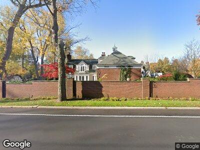
26 Glenwood Rd Roslyn, NY 11576
Roslyn Harbor NeighborhoodEstimated Value: $3,090,000 - $3,124,926
22
Beds
23
Baths
4,576
Sq Ft
$679/Sq Ft
Est. Value
About This Home
This home is located at 26 Glenwood Rd, Roslyn, NY 11576 and is currently estimated at $3,107,463, approximately $679 per square foot. 26 Glenwood Rd is a home located in Nassau County with nearby schools including North Shore Middle School and North Shore Senior High School.
Ownership History
Date
Name
Owned For
Owner Type
Purchase Details
Closed on
Dec 12, 2024
Sold by
Koppleman Jennifer and Fritz Stacy Koppelman
Bought by
Torabi Shadan
Current Estimated Value
Home Financials for this Owner
Home Financials are based on the most recent Mortgage that was taken out on this home.
Original Mortgage
$1,400,000
Outstanding Balance
$1,397,611
Interest Rate
6.81%
Mortgage Type
New Conventional
Estimated Equity
$1,287,565
Create a Home Valuation Report for This Property
The Home Valuation Report is an in-depth analysis detailing your home's value as well as a comparison with similar homes in the area
Home Values in the Area
Average Home Value in this Area
Purchase History
| Date | Buyer | Sale Price | Title Company |
|---|---|---|---|
| Torabi Shadan | $1,750,000 | Judicial Title |
Source: Public Records
Mortgage History
| Date | Status | Borrower | Loan Amount |
|---|---|---|---|
| Open | Torabi Shadan | $1,400,000 |
Source: Public Records
Tax History Compared to Growth
Tax History
| Year | Tax Paid | Tax Assessment Tax Assessment Total Assessment is a certain percentage of the fair market value that is determined by local assessors to be the total taxable value of land and additions on the property. | Land | Improvement |
|---|---|---|---|---|
| 2024 | $6,446 | $1,440 | $462 | $978 |
| 2023 | $33,948 | $1,575 | $505 | $1,070 |
| 2022 | $37,730 | $1,705 | $547 | $1,158 |
| 2021 | $39,052 | $1,689 | $542 | $1,147 |
| 2020 | $39,168 | $3,510 | $1,820 | $1,690 |
| 2019 | $35,480 | $3,510 | $1,820 | $1,690 |
| 2018 | $35,480 | $3,510 | $0 | $0 |
| 2017 | $26,118 | $3,510 | $1,594 | $1,916 |
| 2016 | $34,185 | $3,510 | $1,594 | $1,916 |
| 2015 | $11,149 | $4,007 | $1,820 | $2,187 |
| 2014 | $11,149 | $4,007 | $1,820 | $2,187 |
| 2013 | $9,661 | $4,007 | $1,820 | $2,187 |
Source: Public Records
Map
Nearby Homes
- 605 Bryant Ave
- 40 Murel Ct
- 35 Montrose Ct
- 738 Motts Cove Rd N
- 112 Scudders Ln
- 720 Bryant Ave
- Lot 824 Bryant Ave
- 25 Fairway Ct
- 4 2nd St
- 10 Shore Rd Unit 309
- 10 Shore Rd Unit PH409
- 10 Shore Rd Unit 312
- 4 Maple St
- 23 Grove St
- 0 Shore Rd
- 120 Glenwood Rd
- 14 Washington Ave
- 895 Bryant Ave
- 50 Sylvia St
- 39 Wellington Rd