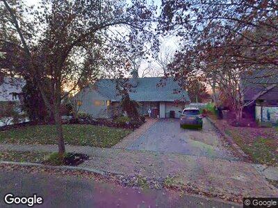
26 Range Dr Merrick, NY 11566
Merrick NeighborhoodEstimated Value: $1,017,103 - $1,440,000
5
Beds
3
Baths
2,884
Sq Ft
$426/Sq Ft
Est. Value
About This Home
This home is located at 26 Range Dr, Merrick, NY 11566 and is currently estimated at $1,228,552, approximately $425 per square foot. 26 Range Dr is a home located in Nassau County with nearby schools including Merrick Avenue Middle School, Sanford H Calhoun High School, and Grace Christian Academy.
Ownership History
Date
Name
Owned For
Owner Type
Purchase Details
Closed on
Aug 19, 2021
Sold by
Saraceni Anthony and Saraceni Sal
Bought by
Clifford Jane
Current Estimated Value
Home Financials for this Owner
Home Financials are based on the most recent Mortgage that was taken out on this home.
Original Mortgage
$548,000
Outstanding Balance
$507,254
Interest Rate
2.8%
Mortgage Type
New Conventional
Estimated Equity
$588,117
Purchase Details
Closed on
Mar 10, 2021
Sold by
Saraceni Mattea and Saraceni Louis
Bought by
Saraceni Anthony and Saraceni Sal
Purchase Details
Closed on
Mar 19, 2003
Sold by
Weiss Norman
Bought by
Saraceni Louis
Create a Home Valuation Report for This Property
The Home Valuation Report is an in-depth analysis detailing your home's value as well as a comparison with similar homes in the area
Home Values in the Area
Average Home Value in this Area
Purchase History
| Date | Buyer | Sale Price | Title Company |
|---|---|---|---|
| Clifford Jane | $835,000 | Old Republic National Title | |
| Saraceni Anthony | -- | None Available | |
| Saraceni Louis | $650,000 | -- |
Source: Public Records
Mortgage History
| Date | Status | Borrower | Loan Amount |
|---|---|---|---|
| Open | Clifford Jane | $300,000 | |
| Open | Clifford Jane | $548,000 |
Source: Public Records
Tax History Compared to Growth
Tax History
| Year | Tax Paid | Tax Assessment Tax Assessment Total Assessment is a certain percentage of the fair market value that is determined by local assessors to be the total taxable value of land and additions on the property. | Land | Improvement |
|---|---|---|---|---|
| 2024 | $4,457 | $668 | $252 | $416 |
| 2023 | $20,233 | $716 | $270 | $446 |
| 2022 | $20,233 | $716 | $270 | $446 |
| 2021 | $18,723 | $717 | $270 | $447 |
| 2020 | $10,926 | $707 | $488 | $219 |
| 2019 | $3,182 | $757 | $490 | $267 |
| 2018 | $7,859 | $808 | $0 | $0 |
| 2017 | $7,871 | $858 | $494 | $364 |
| 2016 | $11,177 | $909 | $471 | $438 |
| 2015 | $3,402 | $959 | $443 | $516 |
| 2014 | $3,402 | $959 | $443 | $516 |
| 2013 | $3,391 | $1,009 | $465 | $544 |
Source: Public Records
Map
Nearby Homes
- 138 Hewlett Ave
- 12 Ranch Place
- 15 Range Dr
- 2126 Cayuga Dr
- 17 Oak Brook Ln
- 2176 Cayuga Dr
- 16 Nancy Blvd
- 1931 Miller Place
- 70 Nancy Blvd
- 1918 Carroll Ave
- 2062 Sherman St
- 124 Smith St
- 1907 Carroll Ave
- 2325 Grand Ave
- 131 Thelma Ave
- 2007 Brook Place
- 2080 Washington St
- 1882 Carroll Ave
- 103 Frankel Blvd
- 58 Croydon Dr