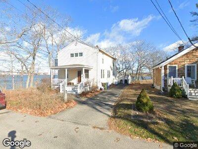
27 Buttonwood St South Portland, ME 04106
Pleasantdale NeighborhoodEstimated Value: $614,000 - $751,059
3
Beds
2
Baths
1,758
Sq Ft
$398/Sq Ft
Est. Value
About This Home
This home is located at 27 Buttonwood St, South Portland, ME 04106 and is currently estimated at $699,265, approximately $397 per square foot. 27 Buttonwood St is a home located in Cumberland County with nearby schools including James Otis Kaler Elementary School, Daniel F. Mahoney Middle School, and South Portland High School.
Ownership History
Date
Name
Owned For
Owner Type
Purchase Details
Closed on
Oct 6, 2014
Sold by
Berry-Dean Timothy and Berry-Dean Jane M
Bought by
Walawender Jeffrey R
Current Estimated Value
Home Financials for this Owner
Home Financials are based on the most recent Mortgage that was taken out on this home.
Original Mortgage
$329,400
Interest Rate
4.11%
Mortgage Type
New Conventional
Create a Home Valuation Report for This Property
The Home Valuation Report is an in-depth analysis detailing your home's value as well as a comparison with similar homes in the area
Home Values in the Area
Average Home Value in this Area
Purchase History
| Date | Buyer | Sale Price | Title Company |
|---|---|---|---|
| Walawender Jeffrey R | -- | -- |
Source: Public Records
Mortgage History
| Date | Status | Borrower | Loan Amount |
|---|---|---|---|
| Open | Walawender Jeffrey R | $300,000 | |
| Closed | Walawender Jeffrey R | $329,400 | |
| Previous Owner | Dean Timothy B | $286,000 | |
| Previous Owner | Berry-Dean Timothy S | $47,000 | |
| Previous Owner | Berry Timothy S | $289,000 |
Source: Public Records
Tax History Compared to Growth
Tax History
| Year | Tax Paid | Tax Assessment Tax Assessment Total Assessment is a certain percentage of the fair market value that is determined by local assessors to be the total taxable value of land and additions on the property. | Land | Improvement |
|---|---|---|---|---|
| 2024 | $8,045 | $609,500 | $265,400 | $344,100 |
| 2023 | $6,596 | $466,500 | $175,000 | $291,500 |
| 2022 | $6,261 | $402,400 | $140,000 | $262,400 |
| 2021 | $5,915 | $402,400 | $140,000 | $262,400 |
| 2020 | $5,319 | $269,300 | $121,200 | $148,100 |
| 2019 | $5,144 | $269,300 | $121,200 | $148,100 |
| 2018 | $5,100 | $275,700 | $121,200 | $154,500 |
| 2017 | $4,963 | $275,700 | $121,200 | $154,500 |
| 2016 | $4,880 | $275,700 | $121,200 | $154,500 |
| 2015 | $4,797 | $275,700 | $121,200 | $154,500 |
| 2014 | $4,687 | $275,700 | $121,200 | $154,500 |
| 2013 | -- | $265,400 | $121,200 | $144,200 |
Source: Public Records
Map
Nearby Homes
- 2 Bennett St Unit 5
- 54 Cole St
- 23 Arrowwood Ct
- Lot B Broadway
- 22 Wisteria Way Unit 22
- 347 Ocean St
- 66 Evans St Unit 12
- 111 Jordan Ave
- 91 S Richland St
- 8 Walnut St
- 276 Danforth St
- 48 Western Promenade
- 132 Walnut St
- 258 Danforth St Unit 1
- 73 O'Neil St
- 43 O'Neil St
- 10 Mast Ln
- 375 Spring St
- 22 Clifford St
- 3 Solar Way Unit 3