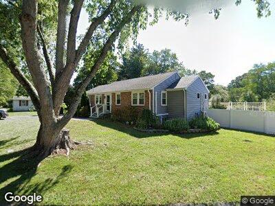
27 Dean Rd Holliston, MA 01746
Estimated Value: $543,000 - $593,982
3
Beds
2
Baths
1,461
Sq Ft
$391/Sq Ft
Est. Value
About This Home
This home is located at 27 Dean Rd, Holliston, MA 01746 and is currently estimated at $571,496, approximately $391 per square foot. 27 Dean Rd is a home located in Middlesex County with nearby schools including Placentino Elementary School, Miller Elementary School, and Robert H. Adams Middle School.
Ownership History
Date
Name
Owned For
Owner Type
Purchase Details
Closed on
Jun 30, 2003
Sold by
Snyder Robert E and Snyder Betty-Jane
Bought by
Buchner Jennifer and Buchner Barbara D
Current Estimated Value
Home Financials for this Owner
Home Financials are based on the most recent Mortgage that was taken out on this home.
Original Mortgage
$212,000
Interest Rate
5.53%
Mortgage Type
Purchase Money Mortgage
Create a Home Valuation Report for This Property
The Home Valuation Report is an in-depth analysis detailing your home's value as well as a comparison with similar homes in the area
Home Values in the Area
Average Home Value in this Area
Purchase History
| Date | Buyer | Sale Price | Title Company |
|---|---|---|---|
| Buchner Jennifer | $265,000 | -- |
Source: Public Records
Mortgage History
| Date | Status | Borrower | Loan Amount |
|---|---|---|---|
| Open | Buchner Barbara D | $174,560 | |
| Closed | Buchner Barbara | $90,000 | |
| Closed | Buchner Barbara D | $86,000 | |
| Closed | Buchner Barbara | $7,500 | |
| Closed | Buchner Jennifer | $212,000 |
Source: Public Records
Tax History Compared to Growth
Tax History
| Year | Tax Paid | Tax Assessment Tax Assessment Total Assessment is a certain percentage of the fair market value that is determined by local assessors to be the total taxable value of land and additions on the property. | Land | Improvement |
|---|---|---|---|---|
| 2025 | $7,713 | $526,500 | $252,100 | $274,400 |
| 2024 | $7,215 | $479,100 | $252,100 | $227,000 |
| 2023 | $7,232 | $469,600 | $252,100 | $217,500 |
| 2022 | $6,312 | $363,200 | $252,100 | $111,100 |
| 2021 | $6,533 | $366,000 | $231,600 | $134,400 |
| 2020 | $6,601 | $350,200 | $230,900 | $119,300 |
| 2019 | $5,958 | $316,400 | $200,800 | $115,600 |
| 2018 | $5,907 | $316,400 | $200,800 | $115,600 |
| 2017 | $5,458 | $294,700 | $193,200 | $101,500 |
| 2016 | $5,083 | $270,500 | $169,000 | $101,500 |
| 2015 | $4,963 | $256,100 | $151,800 | $104,300 |
Source: Public Records
Map
Nearby Homes
- 49 Windsor Dr Unit 105
- 10 Temi Rd
- 236 High St
- 5 Danforth Dr
- 14 Day Rd
- 75 Mohawk Path
- 23 Jarr Brook Rd
- 186 Locust St
- 154 Locust St
- 6 Finn Way
- 152 Turner Rd Unit 2
- 25 High St
- 16 Massachusetts 16
- 221 Trailside Way Unit 221
- 219 Trailside Way
- 64 Meeting House Path
- 136 Dorset Rd
- 77 Trailside Way
- 235 Meeting House Path
- 70 Orchard Ln