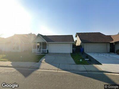
2755 Jeannie Ct Turlock, CA 95382
Geer Ranch NeighborhoodEstimated Value: $377,000 - $404,000
3
Beds
2
Baths
1,165
Sq Ft
$336/Sq Ft
Est. Value
About This Home
This home is located at 2755 Jeannie Ct, Turlock, CA 95382 and is currently estimated at $391,117, approximately $335 per square foot. 2755 Jeannie Ct is a home located in Stanislaus County with nearby schools including Walter M. Brown Elementary School, Marvin A. Dutcher Middle School, and Turlock Junior High School.
Ownership History
Date
Name
Owned For
Owner Type
Purchase Details
Closed on
Feb 3, 2010
Sold by
Alvernaz Investments Llc
Bought by
Zia Marcel
Current Estimated Value
Purchase Details
Closed on
Jan 4, 2010
Sold by
Police Ramin
Bought by
Alvernaz Investments Llc
Purchase Details
Closed on
Jan 13, 1994
Sold by
Cisneros Henry G
Bought by
Police Ramin
Home Financials for this Owner
Home Financials are based on the most recent Mortgage that was taken out on this home.
Original Mortgage
$84,748
Interest Rate
5.75%
Purchase Details
Closed on
Oct 28, 1993
Sold by
Fleet Mtg Corp
Bought by
Hud
Create a Home Valuation Report for This Property
The Home Valuation Report is an in-depth analysis detailing your home's value as well as a comparison with similar homes in the area
Home Values in the Area
Average Home Value in this Area
Purchase History
| Date | Buyer | Sale Price | Title Company |
|---|---|---|---|
| Zia Marcel | $140,000 | Chicago Title Company | |
| Alvernaz Investments Llc | $105,100 | None Available | |
| Police Ramin | $94,500 | North American Title Ins Co | |
| Hud | -- | Fidelity National Title Insu |
Source: Public Records
Mortgage History
| Date | Status | Borrower | Loan Amount |
|---|---|---|---|
| Previous Owner | Police Ramin | $181,000 | |
| Previous Owner | Police Ramin | $227,250 | |
| Previous Owner | Police Ramin | $149,100 | |
| Previous Owner | Police Ramin | $21,300 | |
| Previous Owner | Police Ramin | $84,748 |
Source: Public Records
Tax History Compared to Growth
Tax History
| Year | Tax Paid | Tax Assessment Tax Assessment Total Assessment is a certain percentage of the fair market value that is determined by local assessors to be the total taxable value of land and additions on the property. | Land | Improvement |
|---|---|---|---|---|
| 2024 | $1,905 | $177,156 | $56,940 | $120,216 |
| 2023 | $1,902 | $173,683 | $55,824 | $117,859 |
| 2022 | $1,878 | $170,279 | $54,730 | $115,549 |
| 2021 | $1,851 | $166,941 | $53,657 | $113,284 |
| 2020 | $1,838 | $165,230 | $53,107 | $112,123 |
| 2019 | $1,807 | $161,991 | $52,066 | $109,925 |
| 2018 | $1,805 | $158,816 | $51,046 | $107,770 |
| 2017 | $1,763 | $155,703 | $50,046 | $105,657 |
| 2016 | $1,647 | $152,651 | $49,065 | $103,586 |
| 2015 | $1,633 | $150,359 | $48,328 | $102,031 |
| 2014 | $1,617 | $147,415 | $47,382 | $100,033 |
Source: Public Records
Map
Nearby Homes
- 2900 Andre Ln Unit 243
- 2905 Niagra St Unit 168
- 2905 Niagra St Unit 260
- 3058 Andre Ln
- 651 Shadowview Ct
- 672 Shadowview Ct
- 765 Berea Ct
- 845 Berea Dr
- 2213 Dels Ln
- 2020 Drew Ave
- 2060 Loyola Way
- 461 E Tuolumne Rd
- 3121 Cori Ct
- 561 Hedstrom Rd
- 1860 Asbury Ct
- 2240 Oxford Ave
- 3076 Radford Way
- 240 Wabash Dr
- 681 E Minnesota Ave
- 700 Tammi Way