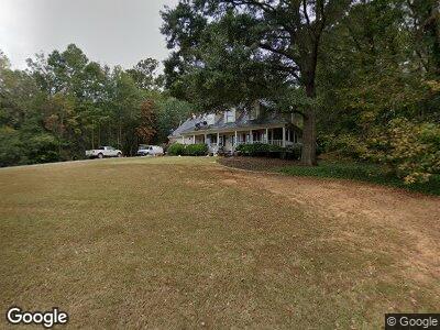
276 Puckett Rd SE Emerson, GA 30137
Estimated Value: $383,000 - $407,000
3
Beds
3
Baths
1,850
Sq Ft
$215/Sq Ft
Est. Value
About This Home
This home is located at 276 Puckett Rd SE, Emerson, GA 30137 and is currently estimated at $398,063, approximately $215 per square foot. 276 Puckett Rd SE is a home located in Bartow County with nearby schools including Emerson Elementary School, Red Top Middle School, and Woodland High School.
Ownership History
Date
Name
Owned For
Owner Type
Purchase Details
Closed on
Apr 26, 2005
Sold by
Castleberry Edwin Cliff
Bought by
Farmer Bruce W and Denson Amy M
Current Estimated Value
Home Financials for this Owner
Home Financials are based on the most recent Mortgage that was taken out on this home.
Original Mortgage
$176,305
Interest Rate
5.98%
Mortgage Type
FHA
Create a Home Valuation Report for This Property
The Home Valuation Report is an in-depth analysis detailing your home's value as well as a comparison with similar homes in the area
Home Values in the Area
Average Home Value in this Area
Purchase History
| Date | Buyer | Sale Price | Title Company |
|---|---|---|---|
| Farmer Bruce W | $193,000 | -- |
Source: Public Records
Mortgage History
| Date | Status | Borrower | Loan Amount |
|---|---|---|---|
| Open | Farmer Bruce William | $228,800 | |
| Closed | Farmer Bruce W | $162,618 | |
| Closed | Denson Amy M | $34,600 | |
| Closed | Farmer Bruce W | $176,305 |
Source: Public Records
Tax History Compared to Growth
Tax History
| Year | Tax Paid | Tax Assessment Tax Assessment Total Assessment is a certain percentage of the fair market value that is determined by local assessors to be the total taxable value of land and additions on the property. | Land | Improvement |
|---|---|---|---|---|
| 2024 | $3,816 | $141,222 | $38,000 | $103,222 |
| 2023 | $3,816 | $162,354 | $38,000 | $124,354 |
| 2022 | $4,018 | $139,929 | $38,000 | $101,929 |
| 2021 | $3,175 | $108,175 | $31,350 | $76,825 |
| 2020 | $3,091 | $106,825 | $30,000 | $76,825 |
| 2019 | $2,533 | $87,330 | $20,000 | $67,330 |
| 2018 | $2,486 | $85,440 | $20,000 | $65,440 |
| 2017 | $1,297 | $46,920 | $8,000 | $38,920 |
| 2016 | $1,306 | $46,920 | $8,000 | $38,920 |
| 2015 | $1,246 | $44,920 | $8,000 | $36,920 |
| 2014 | -- | $38,000 | $8,000 | $30,000 |
| 2013 | -- | $39,880 | $6,320 | $33,560 |
Source: Public Records
Map
Nearby Homes
- 294 Puckett Rd SE
- 101 Bevil Ridge Rd SE
- 67 Red Top Cir
- 23 Red Top Cir
- 639 Puckett Rd SE
- 118 Park Ridge Cir
- 120 Park Ridge Cir
- 38 Puckett Rd SE
- 42 Puckett Rd SE
- 124 Park Ridge Cir
- 133 Old Alabama Rd SE
- 499 Crown Dr
- 495 Crown Dr
- 493 Crown Dr
- 487 Crown Dr
- 127 Old Alabama Rd SE
- 129 Old Alabama Rd SE
- 131 Old Alabama Rd SE
- 122 Park Ridge Dr
- 126 Park Ridge Cir