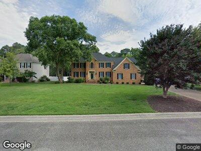
28 Ferguson St Poquoson, VA 23662
Poquoson Shores NeighborhoodEstimated Value: $852,200 - $930,000
5
Beds
3
Baths
3,820
Sq Ft
$237/Sq Ft
Est. Value
About This Home
This home is located at 28 Ferguson St, Poquoson, VA 23662 and is currently estimated at $905,550, approximately $237 per square foot. 28 Ferguson St is a home located in Poquoson City.
Ownership History
Date
Name
Owned For
Owner Type
Purchase Details
Closed on
Apr 10, 2024
Sold by
Lombardi John V and Lombardi Anne C
Bought by
Kim Royce and Fisher Carrie
Current Estimated Value
Home Financials for this Owner
Home Financials are based on the most recent Mortgage that was taken out on this home.
Original Mortgage
$850,000
Outstanding Balance
$841,164
Interest Rate
6.88%
Mortgage Type
New Conventional
Estimated Equity
$64,386
Purchase Details
Closed on
Jul 10, 2009
Sold by
Johnson Dwight E
Bought by
Lombardi John
Home Financials for this Owner
Home Financials are based on the most recent Mortgage that was taken out on this home.
Original Mortgage
$417,000
Interest Rate
5.58%
Mortgage Type
New Conventional
Create a Home Valuation Report for This Property
The Home Valuation Report is an in-depth analysis detailing your home's value as well as a comparison with similar homes in the area
Home Values in the Area
Average Home Value in this Area
Purchase History
| Date | Buyer | Sale Price | Title Company |
|---|---|---|---|
| Kim Royce | $850,000 | Amtrust Title | |
| Lombardi John | $542,500 | -- |
Source: Public Records
Mortgage History
| Date | Status | Borrower | Loan Amount |
|---|---|---|---|
| Open | Kim Royce | $850,000 | |
| Previous Owner | Lombardi John V | $50,000 | |
| Previous Owner | Lombardi John V | $399,556 | |
| Previous Owner | Lombardi John | $417,000 | |
| Previous Owner | Johnson Dwight | $200,000 |
Source: Public Records
Tax History Compared to Growth
Tax History
| Year | Tax Paid | Tax Assessment Tax Assessment Total Assessment is a certain percentage of the fair market value that is determined by local assessors to be the total taxable value of land and additions on the property. | Land | Improvement |
|---|---|---|---|---|
| 2024 | $8,857 | $776,900 | $190,900 | $586,000 |
| 2023 | $7,172 | $646,100 | $190,900 | $455,200 |
| 2022 | $6,615 | $585,400 | $190,900 | $394,500 |
| 2021 | $6,615 | $585,400 | $190,900 | $394,500 |
| 2020 | -- | $563,900 | $190,900 | $373,000 |
| 2019 | -- | $563,900 | $190,900 | $373,000 |
| 2018 | -- | $563,900 | $190,900 | $373,000 |
| 2017 | -- | $551,000 | $190,900 | $360,100 |
| 2016 | -- | $551,000 | $190,900 | $360,100 |
| 2015 | -- | $532,700 | $190,900 | $341,800 |
| 2013 | -- | $532,700 | $190,900 | $341,800 |
Source: Public Records
Map
Nearby Homes
- 205 Darden Dr
- 201 Darden Dr
- 103 Darden Dr
- .51+AC Barbara Ln
- 127 Freemoor Dr
- 40 Valmoore Dr
- 15 Pickins Dr
- 17 Pickins Dr
- 21 Bayview Dr
- 28 Pasture Rd
- 89 Sandy Bay Dr
- 35 Westover Dr
- 2 Rogers Ln
- 1811 Calthrop Neck Rd Unit B
- 310 Bunting Point Rd
- 9 Rue Degrasse
- 14 Wilson Dr
- 31 Kelsor Dr
- 20 Westover Dr
- 3 Saunders Dr