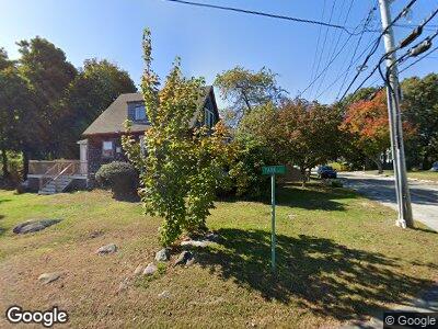
28 Turner Rd Scituate, MA 02066
Estimated Value: $764,000 - $914,000
3
Beds
2
Baths
1,780
Sq Ft
$464/Sq Ft
Est. Value
About This Home
This home is located at 28 Turner Rd, Scituate, MA 02066 and is currently estimated at $825,659, approximately $463 per square foot. 28 Turner Rd is a home located in Plymouth County with nearby schools including Wampatuck Elementary School, Lester J. Gates Middle School, and Scituate High School.
Ownership History
Date
Name
Owned For
Owner Type
Purchase Details
Closed on
Jun 25, 1993
Sold by
Kaminski Stanley D and Day Janniver A
Bought by
Babineau Reginald J and Babineau Deborah R
Current Estimated Value
Home Financials for this Owner
Home Financials are based on the most recent Mortgage that was taken out on this home.
Original Mortgage
$99,300
Interest Rate
7.37%
Mortgage Type
Purchase Money Mortgage
Create a Home Valuation Report for This Property
The Home Valuation Report is an in-depth analysis detailing your home's value as well as a comparison with similar homes in the area
Home Values in the Area
Average Home Value in this Area
Purchase History
| Date | Buyer | Sale Price | Title Company |
|---|---|---|---|
| Babineau Reginald J | $154,000 | -- | |
| Babineau Reginald J | $154,000 | -- |
Source: Public Records
Mortgage History
| Date | Status | Borrower | Loan Amount |
|---|---|---|---|
| Open | Chittick Connor D | $679,150 | |
| Closed | Babineau Reginald J | $100,000 | |
| Closed | Babineau Reginald J | $225,000 | |
| Closed | Babineau Reginald J | $245,000 | |
| Closed | Babineau Reginald J | $135,000 | |
| Closed | Babineau Reginald J | $37,000 | |
| Closed | Babineau Reginald J | $99,300 |
Source: Public Records
Tax History Compared to Growth
Tax History
| Year | Tax Paid | Tax Assessment Tax Assessment Total Assessment is a certain percentage of the fair market value that is determined by local assessors to be the total taxable value of land and additions on the property. | Land | Improvement |
|---|---|---|---|---|
| 2025 | $7,605 | $761,300 | $384,400 | $376,900 |
| 2024 | $7,498 | $723,700 | $349,500 | $374,200 |
| 2023 | $6,798 | $650,700 | $317,700 | $333,000 |
| 2022 | $6,798 | $538,700 | $259,400 | $279,300 |
| 2021 | $6,316 | $473,800 | $234,700 | $239,100 |
| 2020 | $5,935 | $439,600 | $225,600 | $214,000 |
| 2019 | $5,815 | $423,200 | $221,200 | $202,000 |
| 2018 | $5,975 | $428,300 | $239,000 | $189,300 |
| 2017 | $5,894 | $418,300 | $229,000 | $189,300 |
| 2016 | $5,633 | $398,400 | $209,100 | $189,300 |
| 2015 | $5,089 | $388,500 | $199,200 | $189,300 |
Source: Public Records
Map
Nearby Homes
- 23 Lois Ann Ct Unit 23
- 17 Thelma Way Unit 85
- 31 Candlewood Dr
- 36 Thelma Way Unit 36
- 4 Benjamin Ln Unit 62
- 92 Marion Rd
- 79 Kenneth Rd
- 43 Oceanside Dr
- 33 Oceanside Dr
- 50 Oceanside Dr
- 23 Oceanside Dr
- 76 Thelma Way Unit 76
- 85 Thelma Way Unit 85
- 23 Foam Rd
- 24 Spaulding Ave
- 29 Beaver Dam Rd
- 23 Edgar Rd
- 337 Tilden Rd
- 9 Windward Ln
- 11 Egypt Beach Rd