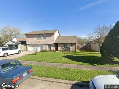
2818 Fir Crest Ct Stafford, TX 77477
Fifth Street NeighborhoodEstimated Value: $227,809 - $257,000
4
Beds
3
Baths
1,518
Sq Ft
$160/Sq Ft
Est. Value
About This Home
This home is located at 2818 Fir Crest Ct, Stafford, TX 77477 and is currently estimated at $243,202, approximately $160 per square foot. 2818 Fir Crest Ct is a home located in Fort Bend County with nearby schools including Dr. Lynn Armstrong Elementary School, Missouri City Middle School, and Thurgood Marshall High School.
Ownership History
Date
Name
Owned For
Owner Type
Purchase Details
Closed on
Apr 8, 2023
Sold by
Mukoro Priye
Bought by
Priye Mukoro Revocable Living Trust
Current Estimated Value
Purchase Details
Closed on
Dec 22, 2000
Sold by
Chen Jon K H and Chen Varin V
Bought by
Mukoro Priye T
Home Financials for this Owner
Home Financials are based on the most recent Mortgage that was taken out on this home.
Original Mortgage
$80,828
Interest Rate
7.73%
Mortgage Type
FHA
Create a Home Valuation Report for This Property
The Home Valuation Report is an in-depth analysis detailing your home's value as well as a comparison with similar homes in the area
Home Values in the Area
Average Home Value in this Area
Purchase History
| Date | Buyer | Sale Price | Title Company |
|---|---|---|---|
| Priye Mukoro Revocable Living Trust | -- | None Listed On Document | |
| Mukoro Priye T | -- | First American Title |
Source: Public Records
Mortgage History
| Date | Status | Borrower | Loan Amount |
|---|---|---|---|
| Previous Owner | Mukoro Priye T | $99,000 | |
| Previous Owner | Mukoro Priye T | $72,000 | |
| Previous Owner | Mukoro Priye T | $77,343 | |
| Previous Owner | Mukoro Priye T | $80,828 |
Source: Public Records
Tax History Compared to Growth
Tax History
| Year | Tax Paid | Tax Assessment Tax Assessment Total Assessment is a certain percentage of the fair market value that is determined by local assessors to be the total taxable value of land and additions on the property. | Land | Improvement |
|---|---|---|---|---|
| 2023 | $2,130 | $200,860 | $0 | $211,315 |
| 2022 | $2,665 | $182,600 | $0 | $189,490 |
| 2021 | $3,113 | $166,000 | $26,500 | $139,500 |
| 2020 | $3,061 | $160,610 | $26,500 | $134,110 |
| 2019 | $2,915 | $146,010 | $22,500 | $123,510 |
| 2018 | $2,657 | $132,740 | $22,500 | $110,240 |
| 2017 | $2,445 | $120,670 | $22,500 | $98,170 |
| 2016 | $2,223 | $109,700 | $22,500 | $87,200 |
| 2015 | $1,569 | $99,730 | $22,500 | $77,230 |
| 2014 | $1,536 | $90,660 | $22,500 | $68,160 |
Source: Public Records
Map
Nearby Homes
- 2811 Park Hill Dr
- 519 Oakdale Dr
- 2814 Park Hill Dr
- 2818 Park Hill Dr
- 2822 Park Hill Dr
- 443 Park Hill Ct
- 2819 Park Hill Dr
- 515 Fair Oak Dr
- 439 W Park Hill
- 2914 Park Hill Ln
- 405 W Park Hill
- 405 W Park Hill
- 405 W Park Hill
- 2942 Park Hill Ln
- 2934 Park Hill Ln
- 2926 Park Hill Ln
- 3506 Lanesborough Dr
- 607 Shady Dale Dr
- 1103 Thomas Jefferson Way
- 3627 Benjamin Franklin Ln