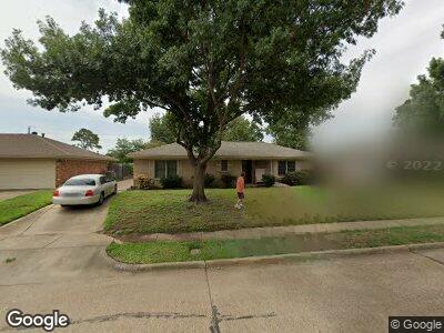
2828 Linden Lea Irving, TX 75061
Sherwood Forest NeighborhoodEstimated Value: $296,622 - $360,000
3
Beds
2
Baths
1,824
Sq Ft
$180/Sq Ft
Est. Value
About This Home
This home is located at 2828 Linden Lea, Irving, TX 75061 and is currently estimated at $327,656, approximately $179 per square foot. 2828 Linden Lea is a home located in Dallas County with nearby schools including Barton Elementary School, Crockett Middle School, and Irving High School.
Ownership History
Date
Name
Owned For
Owner Type
Purchase Details
Closed on
Jun 21, 2023
Sold by
Porter Brian Wayne and Asimakis Diana Porter
Bought by
Asimakis Jason
Current Estimated Value
Purchase Details
Closed on
Nov 2, 2007
Sold by
Porter Brian Wayne and Asimakis Diana Porter
Bought by
Porter Brian Wayne and Asimakis Diana Porter
Purchase Details
Closed on
Jan 14, 1998
Sold by
Porter Kenneth Wayne and Porter Virginia Louise
Bought by
Porter Kenneth Wayne
Create a Home Valuation Report for This Property
The Home Valuation Report is an in-depth analysis detailing your home's value as well as a comparison with similar homes in the area
Home Values in the Area
Average Home Value in this Area
Purchase History
| Date | Buyer | Sale Price | Title Company |
|---|---|---|---|
| Asimakis Jason | -- | None Listed On Document | |
| Porter Brian Wayne | -- | None Available | |
| Porter Kenneth Wayne | -- | -- |
Source: Public Records
Tax History Compared to Growth
Tax History
| Year | Tax Paid | Tax Assessment Tax Assessment Total Assessment is a certain percentage of the fair market value that is determined by local assessors to be the total taxable value of land and additions on the property. | Land | Improvement |
|---|---|---|---|---|
| 2023 | $4,649 | $215,000 | $60,000 | $155,000 |
| 2022 | $5,559 | $271,690 | $0 | $0 |
| 2021 | $4,003 | $165,550 | $60,000 | $105,550 |
| 2020 | $4,154 | $165,550 | $60,000 | $105,550 |
| 2019 | $4,110 | $155,000 | $60,000 | $95,000 |
| 2018 | $3,755 | $140,000 | $40,000 | $100,000 |
| 2017 | $3,777 | $140,200 | $30,000 | $110,200 |
| 2016 | $3,777 | $140,200 | $30,000 | $110,200 |
| 2015 | $3,276 | $121,660 | $22,000 | $99,660 |
| 2014 | $3,276 | $121,660 | $22,000 | $99,660 |
Source: Public Records
Map
Nearby Homes
- 311 Lincolnshire Ct
- 309 Lincolnshire Dr
- 514 Staffordshire Dr
- 517 Robinhood Dr
- 2826 Helmet St
- 2532 Wells Rd
- 701 Fouts Dr
- 637 Cambridge Dr
- 2216 Piedmont St
- 2422 W 4th St
- 800 Patricia St
- 210 Rolston Rd Unit 8
- 210 Rolston Rd
- 2244 Cambridge Dr
- 3219 Woodbrook Ct
- 1906 Dunning St
- 2138 Cambridge Dr
- 526 Roberts Ave
- 310 Wanda Dr
- 3714 W Pioneer Dr Unit Lot 42