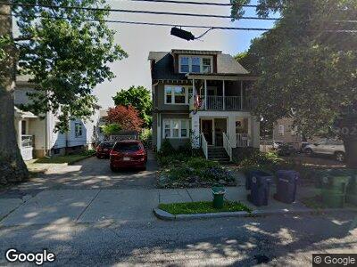
283 Auburndale Ave Unit 285 Auburndale, MA 02466
Auburndale NeighborhoodEstimated Value: $1,219,000 - $1,690,287
7
Beds
4
Baths
3,241
Sq Ft
$452/Sq Ft
Est. Value
About This Home
This home is located at 283 Auburndale Ave Unit 285, Auburndale, MA 02466 and is currently estimated at $1,464,322, approximately $451 per square foot. 283 Auburndale Ave Unit 285 is a home located in Middlesex County with nearby schools including C.C. Burr, F.A. Day Middle School, and Newton North High School.
Create a Home Valuation Report for This Property
The Home Valuation Report is an in-depth analysis detailing your home's value as well as a comparison with similar homes in the area
Home Values in the Area
Average Home Value in this Area
Mortgage History
| Date | Status | Borrower | Loan Amount |
|---|---|---|---|
| Closed | Downie John | $377,000 | |
| Closed | Camilli Elio | $396,000 | |
| Closed | Downie John | $175,000 | |
| Closed | Douglass Anne L | $425,000 | |
| Closed | Camilli Elio | $167,000 | |
| Closed | Camilli Elio | $168,700 |
Source: Public Records
Tax History Compared to Growth
Tax History
| Year | Tax Paid | Tax Assessment Tax Assessment Total Assessment is a certain percentage of the fair market value that is determined by local assessors to be the total taxable value of land and additions on the property. | Land | Improvement |
|---|---|---|---|---|
| 2025 | $13,763 | $1,404,400 | $788,000 | $616,400 |
| 2024 | $13,308 | $1,363,500 | $765,000 | $598,500 |
| 2023 | $12,889 | $1,266,100 | $614,800 | $651,300 |
| 2022 | $12,333 | $1,172,300 | $569,300 | $603,000 |
| 2021 | $11,572 | $1,075,500 | $522,300 | $553,200 |
| 2020 | $11,228 | $1,075,500 | $522,300 | $553,200 |
| 2019 | $10,503 | $1,005,100 | $488,100 | $517,000 |
| 2018 | $10,495 | $970,000 | $458,300 | $511,700 |
| 2017 | $9,896 | $889,900 | $420,500 | $469,400 |
| 2016 | $9,291 | $816,400 | $385,800 | $430,600 |
| 2015 | $8,858 | $763,000 | $360,600 | $402,400 |
Source: Public Records
Map
Nearby Homes
- 17 Staniford St
- 271 Auburn St
- 217 Melrose St Unit 217
- 226 Auburn St Unit 226
- 219 Melrose St Unit 1
- 224-226 Auburn St Unit 1
- 194 Auburn St Unit 2
- 194 Auburn St
- 5 Bencliffe Cir
- 99 Crescent St
- 74 W Pine St
- 40 Central Terrace
- 90 Auburndale Ave
- 109 Auburn St
- 99 Auburn St Unit 99
- 21 Edgewater Park
- 18 Groveland St
- 101-103 Lexington St
- 88 Lexington St
- 0 Duncan Rd Unit 72925240