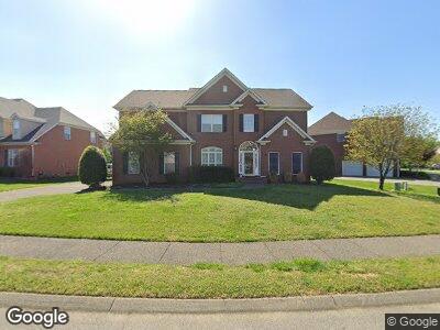
2844 Kaye Dr Thompsons Station, TN 37179
Estimated Value: $619,981 - $755,000
--
Bed
4
Baths
2,984
Sq Ft
$237/Sq Ft
Est. Value
About This Home
This home is located at 2844 Kaye Dr, Thompsons Station, TN 37179 and is currently estimated at $706,745, approximately $236 per square foot. 2844 Kaye Dr is a home located in Williamson County with nearby schools including Primrose School of Spring Hill.
Ownership History
Date
Name
Owned For
Owner Type
Purchase Details
Closed on
Sep 30, 2005
Sold by
Alan D Adams Inc
Bought by
Green Thomas P and Green Jennie
Current Estimated Value
Home Financials for this Owner
Home Financials are based on the most recent Mortgage that was taken out on this home.
Original Mortgage
$271,350
Interest Rate
5.77%
Mortgage Type
Fannie Mae Freddie Mac
Purchase Details
Closed on
May 31, 2005
Sold by
Adams Steve and Adams Jeanine
Bought by
Alan D Adams Inc
Create a Home Valuation Report for This Property
The Home Valuation Report is an in-depth analysis detailing your home's value as well as a comparison with similar homes in the area
Home Values in the Area
Average Home Value in this Area
Purchase History
| Date | Buyer | Sale Price | Title Company |
|---|---|---|---|
| Green Thomas P | $301,500 | Security Title & Escrow Co L | |
| Alan D Adams Inc | -- | -- |
Source: Public Records
Mortgage History
| Date | Status | Borrower | Loan Amount |
|---|---|---|---|
| Open | Green Thomas P | $246,195 | |
| Closed | Green Thomas P | $269,000 | |
| Closed | Green Jennie | $276,000 | |
| Closed | Green Thomas P | $271,350 |
Source: Public Records
Tax History Compared to Growth
Tax History
| Year | Tax Paid | Tax Assessment Tax Assessment Total Assessment is a certain percentage of the fair market value that is determined by local assessors to be the total taxable value of land and additions on the property. | Land | Improvement |
|---|---|---|---|---|
| 2024 | $801 | $108,450 | $23,750 | $84,700 |
| 2023 | $801 | $108,450 | $23,750 | $84,700 |
| 2022 | $1,985 | $108,450 | $23,750 | $84,700 |
| 2021 | $1,985 | $108,450 | $23,750 | $84,700 |
| 2020 | $1,757 | $81,325 | $16,250 | $65,075 |
| 2019 | $1,757 | $81,325 | $16,250 | $65,075 |
| 2018 | $1,700 | $81,325 | $16,250 | $65,075 |
| 2017 | $1,683 | $81,325 | $16,250 | $65,075 |
| 2016 | $0 | $81,325 | $16,250 | $65,075 |
| 2015 | -- | $67,825 | $11,250 | $56,575 |
| 2014 | -- | $67,825 | $11,250 | $56,575 |
Source: Public Records
Map
Nearby Homes
- 1003 Brixworth Dr
- 2824 Kaye Dr
- 1325 Branchside Ct
- 317 Buckwood Ln
- 1528 Bunbury Dr
- 1532 Bunbury Dr
- 2827 Jason Ct
- 4006 Compass Pointe Ct
- 2805 Curacao Ln
- 2604 Hansford Dr
- 2800 Aston Woods Ct
- 460 Buckwood Ave
- 462 Buckwood Ave
- 456 Buckwood Ave
- 458 Buckwood Ave
- 459 Buckwood Ave
- 454 Buckwood Ave
- 452 Buckwood Ave
- 454 Buckwood Ave E
- 2138 Loudenslager Dr