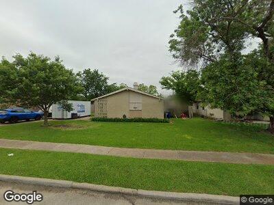
2878 Old Rd N Farmers Branch, TX 75234
Estimated Value: $341,752 - $377,000
3
Beds
2
Baths
1,933
Sq Ft
$186/Sq Ft
Est. Value
About This Home
This home is located at 2878 Old Rd N, Farmers Branch, TX 75234 and is currently estimated at $359,188, approximately $185 per square foot. 2878 Old Rd N is a home located in Dallas County with nearby schools including Blair Elementary School, Field Middle School, and Turner High School.
Ownership History
Date
Name
Owned For
Owner Type
Purchase Details
Closed on
Oct 19, 2011
Sold by
Shrout Stanton E
Bought by
Schlachter Jennifer
Current Estimated Value
Purchase Details
Closed on
Apr 23, 1999
Sold by
Todd James & Associates Inc
Bought by
Shrout Stanton Eugene and Schlachter Jennifer Ann
Home Financials for this Owner
Home Financials are based on the most recent Mortgage that was taken out on this home.
Original Mortgage
$88,654
Interest Rate
7.07%
Mortgage Type
FHA
Purchase Details
Closed on
Feb 10, 1999
Sold by
Perkins Stephen P and Perkins Cynthia S
Bought by
Todd James & Associates Inc
Home Financials for this Owner
Home Financials are based on the most recent Mortgage that was taken out on this home.
Original Mortgage
$68,000
Interest Rate
6.83%
Create a Home Valuation Report for This Property
The Home Valuation Report is an in-depth analysis detailing your home's value as well as a comparison with similar homes in the area
Home Values in the Area
Average Home Value in this Area
Purchase History
| Date | Buyer | Sale Price | Title Company |
|---|---|---|---|
| Schlachter Jennifer | -- | None Available | |
| Shrout Stanton Eugene | -- | American Title Co | |
| Todd James & Associates Inc | -- | -- |
Source: Public Records
Mortgage History
| Date | Status | Borrower | Loan Amount |
|---|---|---|---|
| Previous Owner | Shrout Stanton Eugene | $88,654 | |
| Previous Owner | Todd James & Associates Inc | $68,000 |
Source: Public Records
Tax History Compared to Growth
Tax History
| Year | Tax Paid | Tax Assessment Tax Assessment Total Assessment is a certain percentage of the fair market value that is determined by local assessors to be the total taxable value of land and additions on the property. | Land | Improvement |
|---|---|---|---|---|
| 2023 | $3,601 | $243,680 | $90,000 | $153,680 |
| 2022 | $5,608 | $243,680 | $90,000 | $153,680 |
| 2021 | $4,708 | $195,620 | $80,000 | $115,620 |
| 2020 | $4,858 | $195,620 | $80,000 | $115,620 |
| 2019 | $4,628 | $176,220 | $50,000 | $126,220 |
| 2018 | $4,080 | $154,540 | $50,000 | $104,540 |
| 2017 | $3,798 | $143,400 | $35,000 | $108,400 |
| 2016 | $3,071 | $115,940 | $35,000 | $80,940 |
| 2015 | $2,222 | $108,710 | $35,000 | $73,710 |
| 2014 | $2,222 | $104,370 | $35,000 | $69,370 |
Source: Public Records
Map
Nearby Homes
- 2860 Hollandale Ln
- 2929 Hollandale Ln
- 14423 Sunrose Ln
- 2928 Oxfordshire Ln
- 14504 Dennis Ln
- 3037 Joanna Dr
- 3041 Old Rd N
- 2779 Hollandale Ln
- 2120 Bowie Dr
- 2112 Austin Dr
- 14260 Queens Chapel Rd
- 2231 Bowie Dr
- 14053 Stardust Ln
- 2717 Moonriver Ln
- 2303 Lakeland Dr
- 13943 Lillard Ln
- 14421 Southern Pines Ct
- 14251 Rawhide Pkwy
- 13910 Janwood Ln
- 3141 La Kenta Cir