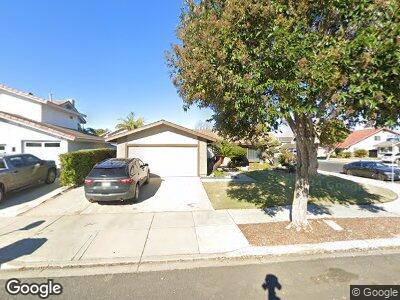
2931 Luff Ct Oxnard, CA 93035
Via Marina NeighborhoodEstimated Value: $693,923 - $845,000
3
Beds
2
Baths
1,547
Sq Ft
$511/Sq Ft
Est. Value
About This Home
This home is located at 2931 Luff Ct, Oxnard, CA 93035 and is currently estimated at $791,231, approximately $511 per square foot. 2931 Luff Ct is a home located in Ventura County with nearby schools including Christa Mcauliffe Elementary School and Oxnard High School.
Ownership History
Date
Name
Owned For
Owner Type
Purchase Details
Closed on
Oct 29, 2021
Sold by
Nicolle Gregory S and Nicolle Harumi Wendy
Bought by
Nicolle Harumi Wendy Terada
Current Estimated Value
Purchase Details
Closed on
May 7, 2021
Sold by
Nicolle Harumi Wendy Terada
Bought by
Nicolle Gregory S and Nicolle Harumi Wendy
Purchase Details
Closed on
Apr 15, 2021
Sold by
Terada Chiiho
Bought by
Terada Trust and Nicolle
Purchase Details
Closed on
Oct 15, 2020
Sold by
Terada Chiiho
Bought by
Terada Chiiho and Terada Trust
Create a Home Valuation Report for This Property
The Home Valuation Report is an in-depth analysis detailing your home's value as well as a comparison with similar homes in the area
Home Values in the Area
Average Home Value in this Area
Purchase History
| Date | Buyer | Sale Price | Title Company |
|---|---|---|---|
| Nicolle Harumi Wendy Terada | -- | None Available | |
| Nicolle Gregory S | -- | None Available | |
| Nicolle Harumi Wendy Terada | -- | None Available | |
| Terada Trust | -- | -- | |
| Terada Chiiho | -- | None Available |
Source: Public Records
Tax History Compared to Growth
Tax History
| Year | Tax Paid | Tax Assessment Tax Assessment Total Assessment is a certain percentage of the fair market value that is determined by local assessors to be the total taxable value of land and additions on the property. | Land | Improvement |
|---|---|---|---|---|
| 2024 | $6,467 | $522,063 | $241,605 | $280,458 |
| 2023 | $6,231 | $511,827 | $236,868 | $274,959 |
| 2022 | $6,044 | $501,792 | $232,224 | $269,568 |
| 2021 | $5,996 | $491,953 | $227,670 | $264,283 |
| 2020 | $3,048 | $240,963 | $84,242 | $156,721 |
| 2019 | $2,962 | $236,240 | $82,591 | $153,649 |
| 2018 | $2,921 | $231,609 | $80,972 | $150,637 |
| 2017 | $2,774 | $227,069 | $79,385 | $147,684 |
| 2016 | $2,677 | $222,618 | $77,829 | $144,789 |
| 2015 | $2,706 | $219,276 | $76,661 | $142,615 |
| 2014 | $2,676 | $214,982 | $75,160 | $139,822 |
Source: Public Records
Map
Nearby Homes
- 1215 Lawrence Way
- 1126 Lawrence Way
- 1201 Masthead Dr
- 1430 Alturas St
- 2771 Bolker Dr
- 2664 Foghorn Cove
- 3301 Regatta Place
- 2660 Barnacle Cove
- 2723 Bolker Way
- 610 W Hemlock St
- 2598 Kayak Cove
- 82 W Garden Green
- 66 W Garden Green
- 2673 Amy Place
- 486 Las Palomas Dr
- 466 Las Palomas Dr
- 2575 Northstar Cove
- 470 Broderick Way
- 2604 Rudder Ave
- 3012 Dunkirk Dr