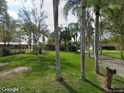
2957 Paolini Dr Deland, FL 32720
Daisy Lake NeighborhoodEstimated Value: $501,000 - $602,225
3
Beds
2
Baths
1,915
Sq Ft
$288/Sq Ft
Est. Value
About This Home
This home is located at 2957 Paolini Dr, Deland, FL 32720 and is currently estimated at $551,613, approximately $288 per square foot. 2957 Paolini Dr is a home located in Volusia County with nearby schools including Woodward Avenue Elementary School, Deland High School, and Southwestern Middle School.
Ownership History
Date
Name
Owned For
Owner Type
Purchase Details
Closed on
Feb 17, 2004
Sold by
Paolini Luciano and Paolini Doris
Bought by
Gladney Richard and Gladney Karen
Current Estimated Value
Purchase Details
Closed on
May 27, 1999
Sold by
Mclarty Lawrence L and Mclarty Jane H
Bought by
Gladney Richard and Gladney Karen
Purchase Details
Closed on
Oct 15, 1987
Bought by
Gladney Richard
Purchase Details
Closed on
Apr 15, 1985
Bought by
Gladney Richard
Purchase Details
Closed on
Sep 15, 1980
Bought by
Gladney Richard
Create a Home Valuation Report for This Property
The Home Valuation Report is an in-depth analysis detailing your home's value as well as a comparison with similar homes in the area
Home Values in the Area
Average Home Value in this Area
Purchase History
| Date | Buyer | Sale Price | Title Company |
|---|---|---|---|
| Gladney Richard | -- | -- | |
| Gladney Richard | $150,500 | -- | |
| Gladney Richard | $138,000 | -- | |
| Gladney Richard | $20,000 | -- | |
| Gladney Richard | $11,500 | -- |
Source: Public Records
Tax History Compared to Growth
Tax History
| Year | Tax Paid | Tax Assessment Tax Assessment Total Assessment is a certain percentage of the fair market value that is determined by local assessors to be the total taxable value of land and additions on the property. | Land | Improvement |
|---|---|---|---|---|
| 2025 | $2,858 | $199,141 | -- | -- |
| 2024 | $2,858 | $193,529 | -- | -- |
| 2023 | $2,858 | $187,893 | $0 | $0 |
| 2022 | $2,876 | $182,420 | $0 | $0 |
| 2021 | $2,974 | $177,107 | $0 | $0 |
| 2020 | $2,930 | $174,662 | $0 | $0 |
| 2019 | $3,019 | $170,735 | $0 | $0 |
| 2018 | $3,008 | $167,552 | $0 | $0 |
| 2017 | $3,008 | $164,106 | $0 | $0 |
| 2016 | $2,873 | $160,731 | $0 | $0 |
| 2015 | $2,929 | $159,614 | $0 | $0 |
| 2014 | $2,899 | $158,347 | $0 | $0 |
Source: Public Records
Map
Nearby Homes
- 0 0 Unit A11467165
- 359 Paradise Dr
- 259 Paradise Dr
- 0 Belinda Dr Unit MFRR4908902
- 2870 Belinda Dr
- 0 Old New York Ave Unit MFRV4936121
- 0 Old New York Ave Unit MFRV4935832
- 1507 Hontoon Rd
- 2505 Old New York Ave
- 1518 Lakeside Dr
- 1534 Center St
- 1552 Lakeside Dr
- 1606 Center St
- 1617 Hontoon Rd
- 0 West Pkwy
- 1250 Lakeview Dr Unit 53
- 1250 Lakeview Dr Unit 17
- 1732 Carnelian St
- 1744 Carnelian St
- 1740 Carnelian St
