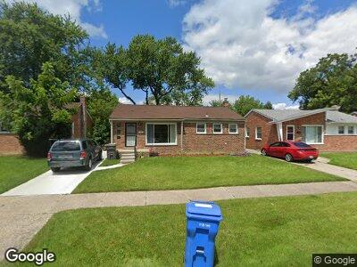
29720 Spring Arbor Dr Inkster, MI 48141
Estimated Value: $101,000 - $141,000
3
Beds
1
Bath
1,000
Sq Ft
$118/Sq Ft
Est. Value
About This Home
This home is located at 29720 Spring Arbor Dr, Inkster, MI 48141 and is currently estimated at $117,686, approximately $117 per square foot. 29720 Spring Arbor Dr is a home located in Wayne County with nearby schools including David Hicks School, Adams Middle School, and Benjamin Franklin Middle School.
Ownership History
Date
Name
Owned For
Owner Type
Purchase Details
Closed on
Feb 4, 2012
Sold by
Vanover Isaac
Bought by
Williams Margaret
Current Estimated Value
Purchase Details
Closed on
May 19, 2008
Sold by
Wells Fargo Bank Na
Bought by
Vanover Isaac
Purchase Details
Closed on
Dec 5, 2007
Sold by
Option One Mortgage Corp
Bought by
Wells Fargo Bank Na and Mesa Trust 2001-5 Asset Backed Certifica
Purchase Details
Closed on
Jan 22, 2001
Sold by
Claypool Julie
Bought by
Claypool Brian E
Create a Home Valuation Report for This Property
The Home Valuation Report is an in-depth analysis detailing your home's value as well as a comparison with similar homes in the area
Home Values in the Area
Average Home Value in this Area
Purchase History
| Date | Buyer | Sale Price | Title Company |
|---|---|---|---|
| Williams Margaret | -- | None Available | |
| Vanover Isaac | $12,000 | Attorneys Title Agency Inc | |
| Wells Fargo Bank Na | -- | None Available | |
| Option One Mortgage Corp | $52,700 | None Available | |
| Claypool Brian E | -- | -- |
Source: Public Records
Mortgage History
| Date | Status | Borrower | Loan Amount |
|---|---|---|---|
| Open | Williams Margaret | $5,850 |
Source: Public Records
Tax History Compared to Growth
Tax History
| Year | Tax Paid | Tax Assessment Tax Assessment Total Assessment is a certain percentage of the fair market value that is determined by local assessors to be the total taxable value of land and additions on the property. | Land | Improvement |
|---|---|---|---|---|
| 2024 | $772 | $41,800 | $0 | $0 |
| 2023 | $785 | $30,700 | $0 | $0 |
| 2022 | $1,179 | $22,900 | $0 | $0 |
| 2021 | $1,330 | $20,100 | $0 | $0 |
| 2020 | $1,306 | $17,100 | $0 | $0 |
| 2019 | $1,303 | $14,900 | $0 | $0 |
| 2018 | $840 | $13,100 | $0 | $0 |
| 2017 | $788 | $13,200 | $0 | $0 |
| 2016 | $1,271 | $11,600 | $0 | $0 |
| 2015 | $1,840 | $18,400 | $0 | $0 |
| 2013 | $2,580 | $25,800 | $0 | $0 |
| 2012 | $2,638 | $29,200 | $3,200 | $26,000 |
Source: Public Records
Map
Nearby Homes
- 1642 Wellesley St
- 1765 Meadowlane St
- 29159 Parkwood St
- 0 Henry Ruff Rd Unit 25008926
- 0 Henry Ruff Rd Unit 25008868
- 29119 Parkwood St
- 30129 Glenwood St
- 1351 Mar Ann Dr
- 29197 Oakwood St
- 28993 Glenwood St
- 29012 Glenwood St
- 724 Western St
- 30645 Rustic Ln
- 30075 Grandview St
- 2274 Harriet St
- 30815 Avondale St
- 28425 Glenwood St
- 28531 Avondale St
- 30785 Birchwood St
- 1453 S Merriman Rd