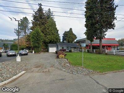
2984 State Highway 16 SW Port Orchard, WA 98367
Gorst NeighborhoodEstimated Value: $242,000 - $432,000
3
Beds
1
Bath
1,048
Sq Ft
$316/Sq Ft
Est. Value
About This Home
This home is located at 2984 State Highway 16 SW, Port Orchard, WA 98367 and is currently estimated at $330,818, approximately $315 per square foot. 2984 State Highway 16 SW is a home located in Kitsap County with nearby schools including Sunnyslope Elementary School, Cedar Heights Middle School, and South Kitsap High School.
Ownership History
Date
Name
Owned For
Owner Type
Purchase Details
Closed on
Feb 12, 2014
Sold by
Fannie Mae
Bought by
Dionas Enterprises Llc
Current Estimated Value
Purchase Details
Closed on
Apr 30, 2013
Sold by
Onewest Bank Fsb
Bought by
Federal National Mortgage Association
Purchase Details
Closed on
Apr 29, 2013
Sold by
Holloway Scott A
Bought by
Onewest Bank Fsb
Purchase Details
Closed on
Apr 20, 2007
Sold by
Lashua James D and Lashua Mercy A
Bought by
Holloway Scott A
Home Financials for this Owner
Home Financials are based on the most recent Mortgage that was taken out on this home.
Original Mortgage
$135,000
Interest Rate
6.11%
Mortgage Type
Purchase Money Mortgage
Purchase Details
Closed on
Jun 22, 2004
Sold by
Winslow Gerald E and Winslow Loma L
Bought by
Lashua James D and Lashua Mercy A
Home Financials for this Owner
Home Financials are based on the most recent Mortgage that was taken out on this home.
Original Mortgage
$63,271
Interest Rate
6.29%
Mortgage Type
Purchase Money Mortgage
Create a Home Valuation Report for This Property
The Home Valuation Report is an in-depth analysis detailing your home's value as well as a comparison with similar homes in the area
Home Values in the Area
Average Home Value in this Area
Purchase History
| Date | Buyer | Sale Price | Title Company |
|---|---|---|---|
| Dionas Enterprises Llc | $561 | Pacific Northwest Title Silv | |
| Federal National Mortgage Association | -- | Land Title | |
| Onewest Bank Fsb | -- | Land Title | |
| Holloway Scott A | $340,280 | Land Title Company | |
| Lashua James D | $77,750 | Land Title Company |
Source: Public Records
Mortgage History
| Date | Status | Borrower | Loan Amount |
|---|---|---|---|
| Open | Dionas Enterprises Llc | $8,000,000 | |
| Previous Owner | Holloway Scott A | $135,000 | |
| Previous Owner | Lashua James D | $63,271 |
Source: Public Records
Tax History Compared to Growth
Tax History
| Year | Tax Paid | Tax Assessment Tax Assessment Total Assessment is a certain percentage of the fair market value that is determined by local assessors to be the total taxable value of land and additions on the property. | Land | Improvement |
|---|---|---|---|---|
| 2025 | $1,720 | $186,430 | $92,060 | $94,370 |
| 2024 | $1,669 | $186,430 | $92,060 | $94,370 |
| 2023 | $1,657 | $186,430 | $92,060 | $94,370 |
| 2022 | $1,089 | $98,520 | $98,520 | $0 |
| 2021 | $1,135 | $98,520 | $98,520 | $0 |
| 2020 | $1,161 | $98,520 | $98,520 | $0 |
| 2019 | $601 | $51,030 | $51,030 | $0 |
| 2018 | $535 | $37,800 | $37,800 | $0 |
| 2017 | $497 | $37,800 | $37,800 | $0 |
| 2016 | $530 | $37,800 | $37,800 | $0 |
| 2015 | $536 | $39,130 | $39,130 | $0 |
| 2014 | -- | $41,050 | $41,050 | $0 |
| 2013 | -- | $47,160 | $20,070 | $27,090 |
Source: Public Records
Map
Nearby Homes
- 3013 W State Highway 16
- 3619 W Frontage Rd
- 4411 Feigley Rd W
- 3336 Mccary Rd SW
- 5970 W Sherman Heights Rd
- 3916 McCormick Village Dr Unit 23
- 3920 McCormick Village Dr Unit 24
- 3904 McCormick Village Dr Unit 20
- 3896 McCormick Village Dr Unit 18
- 3896 McCormick Village Dr
- 3904 McCormick Village Dr
- 3920 McCormick Village Dr
- 3911 McCormick Village Dr
- 3900 McCormick Village Dr
- 3916 McCormick Village Dr
- 3911 McCormick Village Dr Unit 58
- 3899 McCormick Village Dr Unit 55
- 3903 McCormick Village Dr Unit 56
- 3876 McCormick Village Dr
- 3876 McCormick Village Dr Unit 13