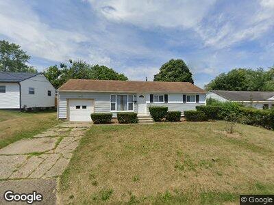
3011 Maxine Ave NE Canton, OH 44705
Fairmount NeighborhoodEstimated Value: $72,793 - $137,000
3
Beds
2
Baths
990
Sq Ft
$99/Sq Ft
Est. Value
About This Home
This home is located at 3011 Maxine Ave NE, Canton, OH 44705 and is currently estimated at $97,698, approximately $98 per square foot. 3011 Maxine Ave NE is a home located in Stark County with nearby schools including Ransom H. Barr Elementary School, Glenwood Intermediate School, and GlenOak High School.
Ownership History
Date
Name
Owned For
Owner Type
Purchase Details
Closed on
Mar 25, 2024
Sold by
Roy T Rhodes Revocable Trust
Bought by
Smyth Daniel J
Current Estimated Value
Purchase Details
Closed on
Nov 28, 2023
Sold by
Rhodes Roy T
Bought by
Roy T Rhodes Revocable Trust and Rhodes
Purchase Details
Closed on
Oct 24, 2023
Sold by
American Homeowner Preservation Trust
Bought by
Rhodes Roy T
Purchase Details
Closed on
Aug 25, 2023
Sold by
Sheriff Of Stark County
Bought by
American Homeowner Preservation Trust and Dunbar
Create a Home Valuation Report for This Property
The Home Valuation Report is an in-depth analysis detailing your home's value as well as a comparison with similar homes in the area
Home Values in the Area
Average Home Value in this Area
Purchase History
| Date | Buyer | Sale Price | Title Company |
|---|---|---|---|
| Smyth Daniel J | -- | None Listed On Document | |
| Roy T Rhodes Revocable Trust | -- | None Listed On Document | |
| Rhodes Roy T | -- | None Listed On Document | |
| American Homeowner Preservation Trust | $53,319 | None Listed On Document |
Source: Public Records
Mortgage History
| Date | Status | Borrower | Loan Amount |
|---|---|---|---|
| Previous Owner | Dunbar James David | $51,736 | |
| Previous Owner | Dunbar James David | $10,000 |
Source: Public Records
Tax History Compared to Growth
Tax History
| Year | Tax Paid | Tax Assessment Tax Assessment Total Assessment is a certain percentage of the fair market value that is determined by local assessors to be the total taxable value of land and additions on the property. | Land | Improvement |
|---|---|---|---|---|
| 2024 | -- | $32,590 | $10,570 | $22,020 |
| 2023 | $2,964 | $23,380 | $5,390 | $17,990 |
| 2022 | $1,414 | $23,380 | $5,390 | $17,990 |
| 2021 | $1,478 | $23,380 | $5,390 | $17,990 |
| 2020 | $1,418 | $20,230 | $4,620 | $15,610 |
| 2019 | $2,230 | $20,230 | $4,620 | $15,610 |
| 2018 | $835 | $20,230 | $4,620 | $15,610 |
| 2017 | $3,223 | $17,610 | $4,690 | $12,920 |
| 2016 | $3,735 | $17,610 | $4,690 | $12,920 |
| 2015 | $478 | $17,610 | $4,690 | $12,920 |
| 2014 | $883 | $17,750 | $4,730 | $13,020 |
| 2013 | $244 | $17,750 | $4,730 | $13,020 |
Source: Public Records
Map
Nearby Homes
- 2809 Dorothy Ave NE
- 2515 30th St NE
- 2802 25th St NE
- 2807 Columbus Rd NE
- 2700 Coventry Blvd NE
- 2458 Cathy Dr NE
- 2635 Daleford Ave NE
- 2216 34th St NE
- 2116 Harmont Ave NE
- 2014 29th St NE
- 2127 26th St NE
- 2618 Ellis Ave NE
- 4103 Will St NE
- 2319 Daleford Ave NE
- 2550 Ellis Ave NE
- 3421 Mahoning Rd NE
- 3804 Mahoning Rd NE
- 2425 Harrisburg Rd NE
- 2035 23rd St NE
- 2124 41st St NE