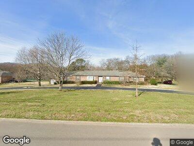
303 Appomattox Dr Brentwood, TN 37027
Estimated Value: $1,206,926 - $3,472,000
--
Bed
3
Baths
7,819
Sq Ft
$229/Sq Ft
Est. Value
About This Home
This home is located at 303 Appomattox Dr, Brentwood, TN 37027 and is currently estimated at $1,786,732, approximately $228 per square foot. 303 Appomattox Dr is a home located in Williamson County with nearby schools including Scales Elementary School, Brentwood Middle School, and Brentwood High School.
Ownership History
Date
Name
Owned For
Owner Type
Purchase Details
Closed on
Aug 28, 2023
Sold by
Smith Margaret Rutledge
Bought by
Margaret Rutledge Smith Revocable Trust and Smith
Current Estimated Value
Purchase Details
Closed on
Jul 27, 2023
Sold by
Margaret Rutledge Smith Revocable Trust
Bought by
Smith Margaret Rutledge
Purchase Details
Closed on
Feb 15, 2023
Sold by
Oi Jiro and Oi Karen
Bought by
Margaret Rutledge Smith Revocable Trust
Create a Home Valuation Report for This Property
The Home Valuation Report is an in-depth analysis detailing your home's value as well as a comparison with similar homes in the area
Home Values in the Area
Average Home Value in this Area
Purchase History
| Date | Buyer | Sale Price | Title Company |
|---|---|---|---|
| Margaret Rutledge Smith Revocable Trust | -- | Dlo Title | |
| Smith Margaret Rutledge | -- | Dlo Title | |
| Margaret Rutledge Smith Revocable Trust | $1,092,000 | Rudy Title & Escrow |
Source: Public Records
Mortgage History
| Date | Status | Borrower | Loan Amount |
|---|---|---|---|
| Previous Owner | Oi Jiro | $64,900 | |
| Previous Owner | Oi Jiro | $21,000 |
Source: Public Records
Tax History Compared to Growth
Tax History
| Year | Tax Paid | Tax Assessment Tax Assessment Total Assessment is a certain percentage of the fair market value that is determined by local assessors to be the total taxable value of land and additions on the property. | Land | Improvement |
|---|---|---|---|---|
| 2024 | $1,709 | $78,750 | $78,750 | -- |
| 2023 | $4,094 | $188,650 | $78,750 | $109,900 |
| 2022 | $4,094 | $188,650 | $78,750 | $109,900 |
| 2021 | $4,094 | $188,650 | $78,750 | $109,900 |
| 2020 | $3,582 | $138,825 | $53,750 | $85,075 |
| 2019 | $3,582 | $138,825 | $53,750 | $85,075 |
| 2018 | $3,485 | $138,825 | $53,750 | $85,075 |
| 2017 | $3,457 | $138,825 | $53,750 | $85,075 |
| 2016 | $0 | $138,825 | $53,750 | $85,075 |
| 2015 | -- | $108,250 | $43,750 | $64,500 |
| 2014 | $476 | $108,250 | $43,750 | $64,500 |
Source: Public Records
Map
Nearby Homes
- 305 Appomattox Dr
- 305 Granny White Pike
- 303 Long Valley Rd
- 305 Hayeswood Dr
- 6101 Belle Rive Dr
- 6020 Landmark Place
- 5231 Williamsburg Rd
- 1241 Old Hickory Blvd
- 6102 Martingale Ln
- 6103 Martingale Ln
- 528 Waxwood Dr
- 6224 Waxwood Ct
- 102 Foxborough Square W
- 549 Turtle Creek Dr
- 513 Waxwood Dr
- 6301 Belle Rive Dr
- 651 Post Oak Cir
- 1411 Old Hickory Blvd
- 5634 Hickory Springs Rd
- 6 Agincourt Way