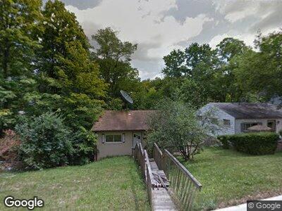
3070 Percy Ave Cincinnati, OH 45211
Westwood NeighborhoodEstimated Value: $53,000 - $212,000
2
Beds
1
Bath
899
Sq Ft
$125/Sq Ft
Est. Value
About This Home
This home is located at 3070 Percy Ave, Cincinnati, OH 45211 and is currently estimated at $112,333, approximately $124 per square foot. 3070 Percy Ave is a home located in Hamilton County with nearby schools including Dater Montessori Elementary School, Western Hills High School, and Gilbert A. Dater High School.
Ownership History
Date
Name
Owned For
Owner Type
Purchase Details
Closed on
Nov 5, 2018
Sold by
Hamilton County
Bought by
Hamilton County Land Reutilization Corpo
Current Estimated Value
Home Financials for this Owner
Home Financials are based on the most recent Mortgage that was taken out on this home.
Original Mortgage
$100
Interest Rate
4.7%
Mortgage Type
Unknown
Purchase Details
Closed on
Jul 5, 2005
Sold by
Powell Robert and Powell Jerone
Bought by
Powell Jerome and Powell Roberta
Home Financials for this Owner
Home Financials are based on the most recent Mortgage that was taken out on this home.
Original Mortgage
$80,000
Interest Rate
7.39%
Mortgage Type
Fannie Mae Freddie Mac
Create a Home Valuation Report for This Property
The Home Valuation Report is an in-depth analysis detailing your home's value as well as a comparison with similar homes in the area
Home Values in the Area
Average Home Value in this Area
Purchase History
| Date | Buyer | Sale Price | Title Company |
|---|---|---|---|
| Hamilton County Land Reutilization Corpo | -- | None Available | |
| Powell Jerome | -- | None Available |
Source: Public Records
Mortgage History
| Date | Status | Borrower | Loan Amount |
|---|---|---|---|
| Open | Hamilton County Land Reubilization Corp | $25,000 | |
| Closed | Hamilton County Land Reutilization Corp | $100 | |
| Previous Owner | Powell Jerome | $80,000 | |
| Previous Owner | Banks Roberta | $5,000 | |
| Previous Owner | Powell Jerome | $25,220 |
Source: Public Records
Tax History Compared to Growth
Tax History
| Year | Tax Paid | Tax Assessment Tax Assessment Total Assessment is a certain percentage of the fair market value that is determined by local assessors to be the total taxable value of land and additions on the property. | Land | Improvement |
|---|---|---|---|---|
| 2024 | $316 | $4,998 | $4,998 | -- |
| 2023 | $316 | $4,998 | $4,998 | $0 |
| 2022 | $279 | $3,969 | $3,969 | $0 |
| 2021 | $275 | $3,969 | $3,969 | $0 |
| 2020 | $276 | $3,969 | $3,969 | $0 |
| 2019 | $1,112 | $14,308 | $3,969 | $10,339 |
| 2018 | $1,076 | $14,308 | $3,969 | $10,339 |
| 2017 | $1,811 | $14,308 | $3,969 | $10,339 |
| 2016 | $1,414 | $19,632 | $5,072 | $14,560 |
| 2015 | $1,276 | $19,632 | $5,072 | $14,560 |
| 2014 | $1,372 | $19,632 | $5,072 | $14,560 |
| 2013 | $1,419 | $21,340 | $5,513 | $15,827 |
Source: Public Records
Map
Nearby Homes
- 3064 Mchenry Ave
- 2482 Harrison Ave
- 3107 Bracken Woods Ln
- 2910 Grasselli Ave
- 2537 Foxcove Ct
- 2533 Foxcove Ct
- 2529 Foxcove Ct
- 2521 Foxcove Ct
- 2523 Foxcove Ct
- 2596 Westwood Northern Blvd
- 3004 Aquadale Ln
- 2727 Faber Ave
- 2725 Faber Ave
- 2525 Foxcove Ct
- 2949 Aquadale Ln
- 2874 Cyclorama Dr
- 3413 Millrich Ave
- 2931 Ravogli Ave
- 3322 Felicity Dr
- 3374 Bighorn Ct