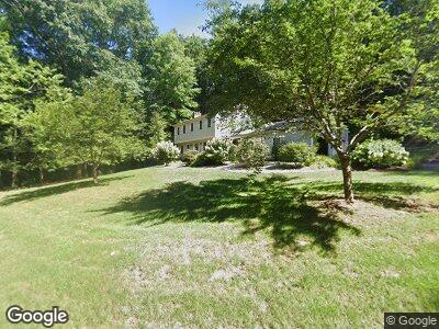
31 Bridle Path Amherst, MA 01002
Amherst NeighborhoodEstimated Value: $602,323 - $651,000
4
Beds
3
Baths
2,076
Sq Ft
$298/Sq Ft
Est. Value
About This Home
This home is located at 31 Bridle Path, Amherst, MA 01002 and is currently estimated at $619,331, approximately $298 per square foot. 31 Bridle Path is a home located in Hampshire County with nearby schools including Fort River Elementary School, Amherst Regional Middle School, and Amherst Regional High School.
Ownership History
Date
Name
Owned For
Owner Type
Purchase Details
Closed on
Nov 2, 2018
Sold by
Sorcinelli Eugenio G and Sorcinelli Mary D
Bought by
Sorcinelli-Smith Mia D and Sorcinelli Julia R
Current Estimated Value
Create a Home Valuation Report for This Property
The Home Valuation Report is an in-depth analysis detailing your home's value as well as a comparison with similar homes in the area
Home Values in the Area
Average Home Value in this Area
Purchase History
| Date | Buyer | Sale Price | Title Company |
|---|---|---|---|
| Sorcinelli-Smith Mia D | -- | -- |
Source: Public Records
Mortgage History
| Date | Status | Borrower | Loan Amount |
|---|---|---|---|
| Open | Sorcinelli Mary D | $500,000 | |
| Previous Owner | Sorcinelli Eugenio G | $122,250 | |
| Previous Owner | Sorcinelli Eugenio G | $100,000 | |
| Previous Owner | Sorcinelli Eugenio G | $94,350 |
Source: Public Records
Tax History Compared to Growth
Tax History
| Year | Tax Paid | Tax Assessment Tax Assessment Total Assessment is a certain percentage of the fair market value that is determined by local assessors to be the total taxable value of land and additions on the property. | Land | Improvement |
|---|---|---|---|---|
| 2025 | $100 | $558,300 | $208,200 | $350,100 |
| 2024 | $9,420 | $508,900 | $196,600 | $312,300 |
| 2023 | $9,135 | $454,500 | $179,000 | $275,500 |
| 2022 | $8,661 | $407,200 | $162,600 | $244,600 |
| 2021 | $8,250 | $378,100 | $150,700 | $227,400 |
| 2020 | $8,061 | $378,100 | $150,700 | $227,400 |
| 2019 | $7,813 | $358,400 | $150,700 | $207,700 |
| 2018 | $7,577 | $358,400 | $150,700 | $207,700 |
| 2017 | $7,564 | $346,500 | $143,700 | $202,800 |
| 2016 | $7,353 | $346,500 | $143,700 | $202,800 |
| 2015 | $7,117 | $346,500 | $143,700 | $202,800 |
Source: Public Records
Map
Nearby Homes
- 171 Aubinwood Rd
- 33 Echo Hill Rd
- 27 Webster Ct Unit 27
- 61 S Valley Rd
- 41 S Valley Rd
- 9 Edge Hill Rd
- 11 Dayton Ln
- 57 Tanglewood Rd
- 43 Tamarack Dr
- 495 Old Farm Rd
- 63 Larkspur Dr
- 90 Amherst Rd
- 1300 Federal St Unit 10
- 77 Spaulding St Unit 77
- 124 Linden Ridge Rd
- 118 Linden Ridge Rd
- 121 Amherst Rd
- 19 Indian Pipe Ln
- 0 Red Gate Ln Unit 73348273
- 60 Red Gate Ln