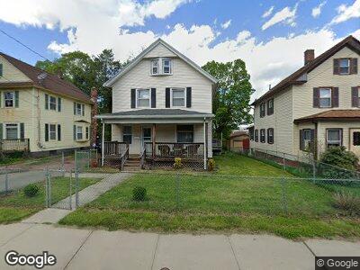
31 Kensington Ave Meriden, CT 06451
Estimated Value: $276,000 - $358,000
5
Beds
2
Baths
2,107
Sq Ft
$146/Sq Ft
Est. Value
About This Home
This home is located at 31 Kensington Ave, Meriden, CT 06451 and is currently estimated at $307,018, approximately $145 per square foot. 31 Kensington Ave is a home located in New Haven County with nearby schools including John Barry School, Lincoln Middle School, and Orville H. Platt High School.
Ownership History
Date
Name
Owned For
Owner Type
Purchase Details
Closed on
Sep 21, 2009
Sold by
Baham Investments Llc
Bought by
Davis Nadja D
Current Estimated Value
Home Financials for this Owner
Home Financials are based on the most recent Mortgage that was taken out on this home.
Original Mortgage
$159,500
Outstanding Balance
$108,914
Interest Rate
5.28%
Estimated Equity
$176,200
Purchase Details
Closed on
Aug 21, 2008
Sold by
Rios William and Rios Beatrice
Bought by
Baham Investments Llc
Purchase Details
Closed on
Aug 28, 2006
Sold by
Fermin Max and Fermin Mitzi
Bought by
Rios William and Rios Beatrice
Home Financials for this Owner
Home Financials are based on the most recent Mortgage that was taken out on this home.
Original Mortgage
$196,350
Interest Rate
9.55%
Create a Home Valuation Report for This Property
The Home Valuation Report is an in-depth analysis detailing your home's value as well as a comparison with similar homes in the area
Home Values in the Area
Average Home Value in this Area
Purchase History
| Date | Buyer | Sale Price | Title Company |
|---|---|---|---|
| Davis Nadja D | $162,500 | -- | |
| Baham Investments Llc | $84,658 | -- | |
| Rios William | $231,000 | -- |
Source: Public Records
Mortgage History
| Date | Status | Borrower | Loan Amount |
|---|---|---|---|
| Open | Davis Nadja D | $6,198 | |
| Open | Fermin Max | $13,514 | |
| Open | Fermin Max | $159,500 | |
| Previous Owner | Fermin Max | $196,350 |
Source: Public Records
Tax History Compared to Growth
Tax History
| Year | Tax Paid | Tax Assessment Tax Assessment Total Assessment is a certain percentage of the fair market value that is determined by local assessors to be the total taxable value of land and additions on the property. | Land | Improvement |
|---|---|---|---|---|
| 2024 | $4,693 | $121,870 | $23,590 | $98,280 |
| 2023 | $4,524 | $121,870 | $23,590 | $98,280 |
| 2022 | $4,268 | $121,870 | $23,590 | $98,280 |
| 2021 | $3,525 | $80,990 | $21,420 | $59,570 |
| 2020 | $3,516 | $80,990 | $21,420 | $59,570 |
| 2019 | $3,486 | $80,990 | $21,420 | $59,570 |
| 2018 | $3,500 | $80,990 | $21,420 | $59,570 |
| 2017 | $3,406 | $80,990 | $21,420 | $59,570 |
| 2016 | $4,346 | $109,480 | $34,300 | $75,180 |
| 2015 | $4,245 | $109,480 | $34,300 | $75,180 |
| 2014 | $4,142 | $109,480 | $34,300 | $75,180 |
Source: Public Records
Map
Nearby Homes
- 115 Wilcox Ave
- 82 Woodland St
- 152 Woodland St
- 50 Howe St
- 64 Fair St
- 330 Center St
- 813 & 819 N Colony Rd
- 301 Blackstone Village
- 7 Linden Place
- 162 Hobart St
- 171 Foster St
- 124 Miller St
- 929 N Colony Rd Unit 6
- 4 Converse Cir
- 14 North St
- 33 W Main St Unit 15
- 33 W Main St Unit 14
- 33 W Main St Unit 13
- 33 W Main St Unit 12
- 33 W Main St Unit 18