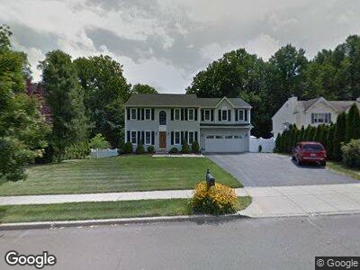
31 Shadows End Ln Milford, CT 06460
Woodmont NeighborhoodEstimated Value: $684,000 - $1,082,000
4
Beds
4
Baths
2,476
Sq Ft
$343/Sq Ft
Est. Value
About This Home
This home is located at 31 Shadows End Ln, Milford, CT 06460 and is currently estimated at $848,370, approximately $342 per square foot. 31 Shadows End Ln is a home located in New Haven County with nearby schools including Orchard Hills School, East Shore Middle School, and Joseph A. Foran High School.
Ownership History
Date
Name
Owned For
Owner Type
Purchase Details
Closed on
Aug 13, 2021
Sold by
Sostilio Nicholas and Sostilio Gail G
Bought by
Nigretti Anthony and Nigretti Kristen
Current Estimated Value
Home Financials for this Owner
Home Financials are based on the most recent Mortgage that was taken out on this home.
Original Mortgage
$548,000
Outstanding Balance
$503,646
Interest Rate
2.9%
Mortgage Type
Purchase Money Mortgage
Estimated Equity
$344,724
Purchase Details
Closed on
Dec 15, 1995
Sold by
T & M Bldg Co Inc
Bought by
Sostilio Nicholas and Sostilio Gail G
Create a Home Valuation Report for This Property
The Home Valuation Report is an in-depth analysis detailing your home's value as well as a comparison with similar homes in the area
Home Values in the Area
Average Home Value in this Area
Purchase History
| Date | Buyer | Sale Price | Title Company |
|---|---|---|---|
| Nigretti Anthony | $710,000 | None Available | |
| Nigretti Anthony | $710,000 | None Available | |
| Sostilio Nicholas | $241,500 | -- | |
| Sostilio Nicholas | $241,500 | -- |
Source: Public Records
Mortgage History
| Date | Status | Borrower | Loan Amount |
|---|---|---|---|
| Open | Nigretti Anthony | $548,000 | |
| Closed | Nigretti Anthony | $548,000 | |
| Previous Owner | Sostilio Gail G | $50,000 | |
| Previous Owner | Sostilio Nicholas | $116,300 | |
| Previous Owner | Sostilio Nicholas | $35,000 | |
| Previous Owner | Sostilio Nicholas | $175,000 |
Source: Public Records
Tax History Compared to Growth
Tax History
| Year | Tax Paid | Tax Assessment Tax Assessment Total Assessment is a certain percentage of the fair market value that is determined by local assessors to be the total taxable value of land and additions on the property. | Land | Improvement |
|---|---|---|---|---|
| 2024 | $12,281 | $421,440 | $127,340 | $294,100 |
| 2023 | $11,451 | $421,440 | $127,340 | $294,100 |
| 2022 | $11,231 | $421,440 | $127,340 | $294,100 |
| 2021 | $10,097 | $365,170 | $105,950 | $259,220 |
| 2020 | $10,108 | $365,170 | $105,950 | $259,220 |
| 2019 | $6,734 | $365,170 | $105,950 | $259,220 |
| 2018 | $10,130 | $365,170 | $105,950 | $259,220 |
| 2017 | $10,148 | $365,170 | $105,950 | $259,220 |
| 2016 | $9,571 | $343,790 | $95,350 | $248,440 |
| 2015 | $9,281 | $332,880 | $95,350 | $237,530 |
| 2014 | $9,061 | $332,880 | $95,350 | $237,530 |
Source: Public Records
Map
Nearby Homes
- 1060 New Haven Ave Unit 14
- 84 Dalton Rd
- 1070 New Haven Ave Unit 56
- 71 Dalton Rd
- 13 Alpha St
- 28 Andover Dr
- 494 Anderson Ave
- 132 Cornflower Dr
- 233 Chapel St
- 110 Sandpiper Cir
- 26 Crestwood Rd
- 9 Sperry St
- 36 Kenwood Rd
- 24 Squire Ct
- 187 Hillside Ave
- 187-189 Hillside Ave
- 38 Soundview Ave
- 211 Merwin Ave
- 127 Hillside Ave
- 45 Stevens St