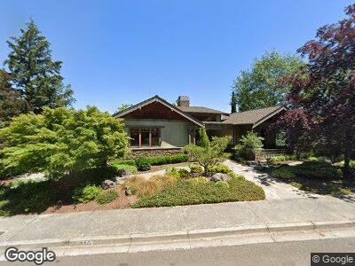
310 High St Ashland, OR 97520
Cottage District NeighborhoodEstimated Value: $823,000 - $1,011,000
3
Beds
3
Baths
2,618
Sq Ft
$338/Sq Ft
Est. Value
About This Home
This home is located at 310 High St, Ashland, OR 97520 and is currently estimated at $886,077, approximately $338 per square foot. 310 High St is a home located in Jackson County with nearby schools including Helman Elementary School, Ashland Middle School, and Ashland High School.
Ownership History
Date
Name
Owned For
Owner Type
Purchase Details
Closed on
Apr 15, 2005
Sold by
Mitchell Kathleen K
Bought by
Crawford Robert D and Crawford Wendy G
Current Estimated Value
Create a Home Valuation Report for This Property
The Home Valuation Report is an in-depth analysis detailing your home's value as well as a comparison with similar homes in the area
Home Values in the Area
Average Home Value in this Area
Purchase History
| Date | Buyer | Sale Price | Title Company |
|---|---|---|---|
| Crawford Robert D | $850,000 | Lawyers Title Ins |
Source: Public Records
Mortgage History
| Date | Status | Borrower | Loan Amount |
|---|---|---|---|
| Open | Crawford Robert D | $50,000 | |
| Previous Owner | Mitchell Kathleen K | $532,490 |
Source: Public Records
Tax History Compared to Growth
Tax History
| Year | Tax Paid | Tax Assessment Tax Assessment Total Assessment is a certain percentage of the fair market value that is determined by local assessors to be the total taxable value of land and additions on the property. | Land | Improvement |
|---|---|---|---|---|
| 2024 | $11,661 | $730,230 | $310,400 | $419,830 |
| 2023 | $11,281 | $708,970 | $301,350 | $407,620 |
| 2022 | $10,920 | $708,970 | $301,350 | $407,620 |
| 2021 | $10,548 | $688,330 | $292,570 | $395,760 |
| 2020 | $10,252 | $668,290 | $284,050 | $384,240 |
| 2019 | $10,090 | $629,940 | $267,740 | $362,200 |
| 2018 | $9,531 | $611,600 | $259,940 | $351,660 |
| 2017 | $9,219 | $611,600 | $259,940 | $351,660 |
| 2016 | $8,818 | $576,500 | $245,020 | $331,480 |
| 2015 | $8,439 | $576,500 | $245,020 | $331,480 |
| 2014 | $7,937 | $543,410 | $230,950 | $312,460 |
Source: Public Records
Map
Nearby Homes
- 75 Wimer St Unit 71,73
- 75 Wimer St
- 319 West St
- 431 N Main St
- 451 N Main St
- 114 Bush St
- 65 Woolen Way
- 323 Glenn St Unit 6
- 180 Ohio St
- 165 Water St
- 381 Glenn St
- 71 Water St Unit 303
- 393 N Laurel St
- 495 Chestnut St Unit 19
- 495 Chestnut St Unit 4
- 165 Orange Ave
- 317 Maple St
- 385 Otis St
- 166 Mountain View Dr
- 583 Coffee Ln