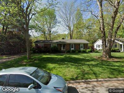
3103 Shady Lawn Dr Greensboro, NC 27408
Westwood NeighborhoodEstimated Value: $324,000 - $359,000
3
Beds
2
Baths
1,679
Sq Ft
$201/Sq Ft
Est. Value
About This Home
This home is located at 3103 Shady Lawn Dr, Greensboro, NC 27408 and is currently estimated at $338,208, approximately $201 per square foot. 3103 Shady Lawn Dr is a home located in Guilford County with nearby schools including General Greene Elementary School, Kiser Middle School, and Grimsley High School.
Ownership History
Date
Name
Owned For
Owner Type
Purchase Details
Closed on
Jul 27, 2005
Sold by
Dahne Patricia E
Bought by
Mccraven Susan S
Current Estimated Value
Home Financials for this Owner
Home Financials are based on the most recent Mortgage that was taken out on this home.
Original Mortgage
$139,500
Interest Rate
4.75%
Mortgage Type
Fannie Mae Freddie Mac
Purchase Details
Closed on
Jul 25, 2003
Sold by
Williams Marcus Wayne
Bought by
Dahne Patricia E
Home Financials for this Owner
Home Financials are based on the most recent Mortgage that was taken out on this home.
Original Mortgage
$111,200
Interest Rate
5.16%
Mortgage Type
Purchase Money Mortgage
Create a Home Valuation Report for This Property
The Home Valuation Report is an in-depth analysis detailing your home's value as well as a comparison with similar homes in the area
Home Values in the Area
Average Home Value in this Area
Purchase History
| Date | Buyer | Sale Price | Title Company |
|---|---|---|---|
| Mccraven Susan S | $155,000 | None Available | |
| Dahne Patricia E | $139,000 | -- |
Source: Public Records
Mortgage History
| Date | Status | Borrower | Loan Amount |
|---|---|---|---|
| Open | Whitesides George H | $37,000 | |
| Open | Whitesides George H | $112,900 | |
| Closed | Whitesides George H | $30,000 | |
| Closed | Mccraven Susan S | $11,800 | |
| Closed | Mccraven Susan S | $139,500 | |
| Previous Owner | Dahne Patricia E | $111,200 |
Source: Public Records
Tax History Compared to Growth
Tax History
| Year | Tax Paid | Tax Assessment Tax Assessment Total Assessment is a certain percentage of the fair market value that is determined by local assessors to be the total taxable value of land and additions on the property. | Land | Improvement |
|---|---|---|---|---|
| 2023 | $3,060 | $218,100 | $57,000 | $161,100 |
| 2022 | $2,973 | $218,100 | $57,000 | $161,100 |
| 2021 | $2,088 | $149,900 | $35,000 | $114,900 |
| 2020 | $2,088 | $149,900 | $35,000 | $114,900 |
| 2019 | $2,088 | $149,900 | $0 | $0 |
| 2018 | $2,028 | $149,900 | $0 | $0 |
| 2017 | $2,043 | $149,900 | $0 | $0 |
| 2016 | $1,955 | $141,200 | $0 | $0 |
| 2015 | $1,966 | $141,200 | $0 | $0 |
| 2014 | $1,980 | $141,200 | $0 | $0 |
Source: Public Records
Map
Nearby Homes
- 3111 Robin Hood Dr
- 3202 Robin Hood Dr
- 509 Edney Ridge Rd
- 2821 Shady Lawn Dr
- 2806 Robin Hood Dr
- 3425 Glouchester Ln
- 2725 Shady Lawn Dr
- 2713 Rockwood Rd
- 1901 Hobbs Rd
- 2405 Pisgah Church Rd
- 10 Devonshire Dr
- 3706 Hobbs Rd
- 3801 Derbyshire Dr
- 3007 Trull Ave
- 3700 Brandywine Dr
- 2901 Martinsville Rd
- 3319 Windrift Dr
- 1403 Worthington Place
- 3805 Hobbs Rd
- 2404 Running Brook Dr