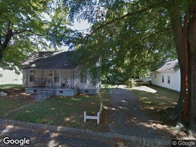
312 E Lowrance Ave Mooresville, NC 28115
Estimated Value: $123,000 - $206,000
2
Beds
1
Bath
1,180
Sq Ft
$150/Sq Ft
Est. Value
About This Home
This home is located at 312 E Lowrance Ave, Mooresville, NC 28115 and is currently estimated at $176,994, approximately $149 per square foot. 312 E Lowrance Ave is a home located in Iredell County with nearby schools including South Elementary School, Mooresville Intermediate School, and Mooresville Middle.
Ownership History
Date
Name
Owned For
Owner Type
Purchase Details
Closed on
Nov 22, 2002
Sold by
Ken Koontz Construction Inc
Bought by
Westmoreland Beverly
Current Estimated Value
Home Financials for this Owner
Home Financials are based on the most recent Mortgage that was taken out on this home.
Original Mortgage
$37,600
Interest Rate
5.95%
Purchase Details
Closed on
Oct 1, 1997
Purchase Details
Closed on
May 1, 1991
Purchase Details
Closed on
Apr 1, 1990
Create a Home Valuation Report for This Property
The Home Valuation Report is an in-depth analysis detailing your home's value as well as a comparison with similar homes in the area
Home Values in the Area
Average Home Value in this Area
Purchase History
| Date | Buyer | Sale Price | Title Company |
|---|---|---|---|
| Westmoreland Beverly | $44,000 | -- | |
| -- | $56,500 | -- | |
| -- | $37,000 | -- | |
| -- | $23,500 | -- | |
| -- | $23,500 | -- |
Source: Public Records
Mortgage History
| Date | Status | Borrower | Loan Amount |
|---|---|---|---|
| Closed | Westmoreland Beverly | $37,600 |
Source: Public Records
Tax History Compared to Growth
Tax History
| Year | Tax Paid | Tax Assessment Tax Assessment Total Assessment is a certain percentage of the fair market value that is determined by local assessors to be the total taxable value of land and additions on the property. | Land | Improvement |
|---|---|---|---|---|
| 2024 | $1,491 | $113,060 | $31,500 | $81,560 |
| 2023 | $1,491 | $113,060 | $31,500 | $81,560 |
| 2022 | $1,115 | $71,790 | $18,000 | $53,790 |
| 2021 | $1,111 | $71,790 | $18,000 | $53,790 |
| 2020 | $1,111 | $71,790 | $18,000 | $53,790 |
| 2019 | $1,104 | $71,790 | $18,000 | $53,790 |
| 2018 | $897 | $56,110 | $10,800 | $45,310 |
| 2017 | $837 | $56,110 | $10,800 | $45,310 |
| 2016 | $837 | $56,110 | $10,800 | $45,310 |
| 2015 | $837 | $56,110 | $10,800 | $45,310 |
| 2014 | $945 | $66,610 | $18,000 | $48,610 |
Source: Public Records
Map
Nearby Homes
- 630 Smith St Unit B
- 620 Smith St Unit B
- 620 Smith St Unit A
- 616 Smith St Unit B
- 616 Smith St Unit A
- 331 Nesbit Ave
- 604 Smith St Unit A
- 000 Ridge Ave
- 444 Oakwood Ave
- 552 Ridge Ave
- 558 Ridge Ave
- 556 Ridge Ave
- 459 Towell St
- 116 Par Place
- 000 Young St
- 130 Club Dr
- 0 Club Dr
- 117 Thayer Ct
- 670 Sherwood Place
- 333 W Wilson Ave