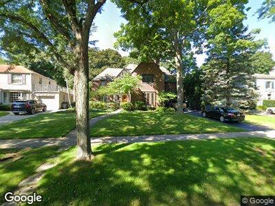
312 Sterling Rd Kenilworth, IL 60043
Kenilworth NeighborhoodEstimated Value: $1,868,000 - $1,922,413
6
Beds
6
Baths
5,000
Sq Ft
$380/Sq Ft
Est. Value
About This Home
This home is located at 312 Sterling Rd, Kenilworth, IL 60043 and is currently estimated at $1,899,103, approximately $379 per square foot. 312 Sterling Rd is a home located in Cook County with nearby schools including The Joseph Sears School, New Trier Township High School, and New Trier Township High School - Northfield.
Ownership History
Date
Name
Owned For
Owner Type
Purchase Details
Closed on
Mar 12, 2002
Sold by
The Northern Trust Company
Bought by
Whisler Hardiman Paul G and Whisler Hardiman Theresa E
Home Financials for this Owner
Home Financials are based on the most recent Mortgage that was taken out on this home.
Original Mortgage
$910,000
Interest Rate
6.5%
Mortgage Type
Unknown
Purchase Details
Closed on
Nov 28, 2001
Sold by
The Northern Trust Company
Bought by
The Northern Trust Company
Purchase Details
Closed on
Sep 19, 2001
Sold by
The Northern Trust Company
Bought by
The Northern Trust Company and Trust #02-10369
Create a Home Valuation Report for This Property
The Home Valuation Report is an in-depth analysis detailing your home's value as well as a comparison with similar homes in the area
Home Values in the Area
Average Home Value in this Area
Purchase History
| Date | Buyer | Sale Price | Title Company |
|---|---|---|---|
| Whisler Hardiman Paul G | $1,300,000 | -- | |
| The Northern Trust Company | -- | -- |
Source: Public Records
Mortgage History
| Date | Status | Borrower | Loan Amount |
|---|---|---|---|
| Open | Hardiman Paul G | $760,000 | |
| Closed | Hardiman Paul G | $200,000 | |
| Closed | Hardiman Paul G | $360,000 | |
| Closed | Whisler Hardiman Paul G | $910,000 |
Source: Public Records
Tax History Compared to Growth
Tax History
| Year | Tax Paid | Tax Assessment Tax Assessment Total Assessment is a certain percentage of the fair market value that is determined by local assessors to be the total taxable value of land and additions on the property. | Land | Improvement |
|---|---|---|---|---|
| 2024 | $27,442 | $122,290 | $39,600 | $82,690 |
| 2023 | $27,442 | $122,290 | $39,600 | $82,690 |
| 2022 | $27,442 | $122,290 | $39,600 | $82,690 |
| 2021 | $30,608 | $109,660 | $25,987 | $83,673 |
| 2020 | $29,807 | $109,660 | $25,987 | $83,673 |
| 2019 | $29,572 | $120,506 | $25,987 | $94,519 |
| 2018 | $26,620 | $106,743 | $22,275 | $84,468 |
| 2017 | $25,847 | $106,743 | $22,275 | $84,468 |
| 2016 | $26,727 | $115,909 | $22,275 | $93,634 |
| 2015 | $24,897 | $95,681 | $18,253 | $77,428 |
| 2014 | $25,789 | $101,552 | $18,253 | $83,299 |
| 2013 | $24,296 | $101,552 | $18,253 | $83,299 |
Source: Public Records
Map
Nearby Homes
- 1041 Ridge Rd Unit 403
- 2038 Greenwood Ave
- 519 Park Dr
- 515 Park Dr
- 912 Cambridge Ln
- 2131 Kenilworth Ave
- 2145 Chestnut Ave
- 1535 Lake Ave
- 701 Ridge Rd Unit 3A
- 631 Exmoor Rd
- 611 Abbotsford Rd
- 338 Woodstock Ave
- 530 Essex Rd
- 643 Abbotsford Rd
- 306 Oxford Rd
- 1336 Washington Ave
- 97 High St
- 1710 Central Ave
- 501 Ridge Rd
- 1222 Chestnut Ave