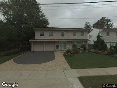
3156 Wynsum Ave Merrick, NY 11566
Merrick NeighborhoodEstimated Value: $1,088,448 - $1,135,000
--
Bed
3
Baths
2,753
Sq Ft
$404/Sq Ft
Est. Value
About This Home
This home is located at 3156 Wynsum Ave, Merrick, NY 11566 and is currently estimated at $1,111,724, approximately $403 per square foot. 3156 Wynsum Ave is a home located in Nassau County with nearby schools including Merrick Avenue Middle School, John F. Kennedy High School, and St. Elizabeth Ann Seton Regional School.
Ownership History
Date
Name
Owned For
Owner Type
Purchase Details
Closed on
Sep 6, 2022
Sold by
Yellin Neil and Yellin Helen Blitzer
Bought by
Levison Gary David and Levison Lauren Cayne
Current Estimated Value
Home Financials for this Owner
Home Financials are based on the most recent Mortgage that was taken out on this home.
Original Mortgage
$799,200
Outstanding Balance
$771,669
Interest Rate
4.25%
Mortgage Type
New Conventional
Estimated Equity
$349,408
Create a Home Valuation Report for This Property
The Home Valuation Report is an in-depth analysis detailing your home's value as well as a comparison with similar homes in the area
Home Values in the Area
Average Home Value in this Area
Purchase History
| Date | Buyer | Sale Price | Title Company |
|---|---|---|---|
| Levison Gary David | $999,000 | Amtrust Title Insurance Co |
Source: Public Records
Mortgage History
| Date | Status | Borrower | Loan Amount |
|---|---|---|---|
| Open | Levison Gary David | $799,200 | |
| Previous Owner | Yellin Neil | $2,562 |
Source: Public Records
Tax History Compared to Growth
Tax History
| Year | Tax Paid | Tax Assessment Tax Assessment Total Assessment is a certain percentage of the fair market value that is determined by local assessors to be the total taxable value of land and additions on the property. | Land | Improvement |
|---|---|---|---|---|
| 2024 | $5,317 | $728 | $286 | $442 |
| 2023 | $18,287 | $767 | $301 | $466 |
| 2022 | $18,287 | $761 | $299 | $462 |
| 2021 | $16,704 | $755 | $296 | $459 |
| 2020 | $15,558 | $932 | $584 | $348 |
| 2019 | $4,171 | $952 | $597 | $355 |
| 2018 | $10,701 | $952 | $0 | $0 |
| 2017 | $9,183 | $952 | $495 | $457 |
| 2016 | $13,013 | $1,148 | $539 | $609 |
| 2015 | $4,504 | $1,212 | $569 | $643 |
| 2014 | $4,504 | $1,212 | $569 | $643 |
| 2013 | $4,475 | $1,272 | $597 | $675 |
Source: Public Records
Map
Nearby Homes
- 3046 Shore Rd
- 3306 Seawane Dr
- 2074 Ellen Dr
- 2121 Ellen Dr
- 2491 Malibu Rd
- 3354 Seawane Dr
- 2470 Cove Ct
- 3032 Hewlett Ave
- 3001 Hewlett Ave
- 2956 Judith Dr
- 2925 Hewlett Ave
- 2479 Kerry Ln
- 3476 E Bay Ct
- 2854 Wynsum Ave
- 2495 Navy Place
- 118 Brighton Way
- 2810 Wynsum Ave
- 2694 Dorothy St
- 2730 Belle Rd
- 2932 Joyce Ln