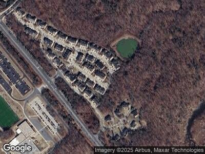
319 Dawnwood Dr Edgewater, MD 21037
Estimated Value: $627,000 - $663,000
--
Bed
4
Baths
2,958
Sq Ft
$219/Sq Ft
Est. Value
About This Home
This home is located at 319 Dawnwood Dr, Edgewater, MD 21037 and is currently estimated at $646,358, approximately $218 per square foot. 319 Dawnwood Dr is a home located in Anne Arundel County with nearby schools including Central Elementary School, Central Middle School, and South River High School.
Ownership History
Date
Name
Owned For
Owner Type
Purchase Details
Closed on
Mar 11, 2025
Sold by
Rodgers Mark D and Rodgers Marla D
Bought by
Stull Brett
Current Estimated Value
Home Financials for this Owner
Home Financials are based on the most recent Mortgage that was taken out on this home.
Original Mortgage
$603,000
Outstanding Balance
$603,000
Interest Rate
6.95%
Mortgage Type
New Conventional
Estimated Equity
$36,179
Purchase Details
Closed on
Jun 11, 2004
Sold by
South River Parcel B Llc
Bought by
Rodgers Mark D and Rodgers Marla D
Home Financials for this Owner
Home Financials are based on the most recent Mortgage that was taken out on this home.
Original Mortgage
$405,228
Interest Rate
4.87%
Mortgage Type
Adjustable Rate Mortgage/ARM
Create a Home Valuation Report for This Property
The Home Valuation Report is an in-depth analysis detailing your home's value as well as a comparison with similar homes in the area
Home Values in the Area
Average Home Value in this Area
Purchase History
| Date | Buyer | Sale Price | Title Company |
|---|---|---|---|
| Stull Brett | $670,000 | Eagle Title | |
| Stull Brett | $670,000 | Eagle Title | |
| Rodgers Mark D | $540,305 | -- |
Source: Public Records
Mortgage History
| Date | Status | Borrower | Loan Amount |
|---|---|---|---|
| Open | Stull Brett | $603,000 | |
| Closed | Stull Brett | $603,000 | |
| Previous Owner | Rodgers Marla D | $292,500 | |
| Previous Owner | Rodgers Mark D | $405,228 | |
| Previous Owner | Rodgers Mark D | $27,015 |
Source: Public Records
Tax History Compared to Growth
Tax History
| Year | Tax Paid | Tax Assessment Tax Assessment Total Assessment is a certain percentage of the fair market value that is determined by local assessors to be the total taxable value of land and additions on the property. | Land | Improvement |
|---|---|---|---|---|
| 2024 | $5,568 | $485,533 | $0 | $0 |
| 2023 | $5,407 | $456,900 | $125,000 | $331,900 |
| 2022 | $5,084 | $450,500 | $0 | $0 |
| 2021 | $10,035 | $444,100 | $0 | $0 |
| 2020 | $4,912 | $437,700 | $125,000 | $312,700 |
| 2019 | $4,916 | $437,700 | $125,000 | $312,700 |
| 2018 | $4,438 | $437,700 | $125,000 | $312,700 |
| 2017 | $4,847 | $460,300 | $0 | $0 |
| 2016 | -- | $453,067 | $0 | $0 |
| 2015 | -- | $445,833 | $0 | $0 |
| 2014 | -- | $438,600 | $0 | $0 |
Source: Public Records
Map
Nearby Homes
- 481 Penwood Dr
- 2054 Shore Dr
- 419 Highland Dr
- 320 Highland Dr
- 1820 Longwood Rd
- 1735 Fairhill Dr
- 1813 Keymar Rd
- 1809 Keymar Rd
- 1666 Bay Ridge Rd
- 1719 Fairhill Dr
- Lot 2604 ,2605 Shore Dr
- 1727 Forestville Rd
- 1347 Shore Dr
- 1640 Bay Ridge Rd
- 203 Black Skimmer Ct
- 3325 Cedar Dr
- 1636 Shady Side Dr
- 1705 Tacoma Rd
- 1637 Fairhill Dr
- 3310 Leritz Ln
