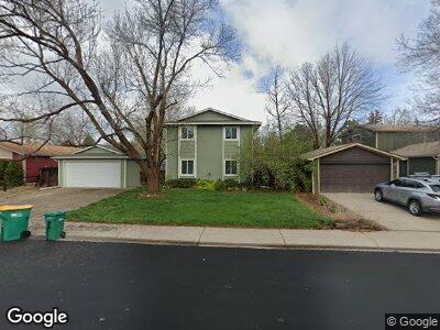
3325 Liverpool St Fort Collins, CO 80526
Rossborough NeighborhoodEstimated Value: $524,000 - $545,000
4
Beds
3
Baths
1,920
Sq Ft
$278/Sq Ft
Est. Value
About This Home
This home is located at 3325 Liverpool St, Fort Collins, CO 80526 and is currently estimated at $532,980, approximately $277 per square foot. 3325 Liverpool St is a home located in Larimer County with nearby schools including Johnson Elementary School, Webber Middle School, and Rocky Mountain High School.
Ownership History
Date
Name
Owned For
Owner Type
Purchase Details
Closed on
Apr 12, 2012
Sold by
Spahr Daniel K and Spahr Kimberly L
Bought by
Rutishauer Rene and Rutishauer Deborah Jackson
Current Estimated Value
Purchase Details
Closed on
Jun 30, 1999
Sold by
Jennings Paul W
Bought by
Spahr Daniel K and Spahr Kimberly L
Home Financials for this Owner
Home Financials are based on the most recent Mortgage that was taken out on this home.
Original Mortgage
$133,855
Interest Rate
7.21%
Purchase Details
Closed on
Feb 1, 1995
Sold by
Digiacomo John
Bought by
Jennings Paul W
Create a Home Valuation Report for This Property
The Home Valuation Report is an in-depth analysis detailing your home's value as well as a comparison with similar homes in the area
Home Values in the Area
Average Home Value in this Area
Purchase History
| Date | Buyer | Sale Price | Title Company |
|---|---|---|---|
| Rutishauer Rene | $170,000 | Fidelity National Title Insu | |
| Spahr Daniel K | $140,900 | -- | |
| Jennings Paul W | $119,900 | -- |
Source: Public Records
Mortgage History
| Date | Status | Borrower | Loan Amount |
|---|---|---|---|
| Previous Owner | Spahr Daniel K | $70,000 | |
| Previous Owner | Spahr Daniel K | $119,453 | |
| Previous Owner | Spahr Daniel K | $15,100 | |
| Previous Owner | Spahr Daniel K | $133,855 |
Source: Public Records
Tax History Compared to Growth
Tax History
| Year | Tax Paid | Tax Assessment Tax Assessment Total Assessment is a certain percentage of the fair market value that is determined by local assessors to be the total taxable value of land and additions on the property. | Land | Improvement |
|---|---|---|---|---|
| 2025 | $2,885 | $35,282 | $2,680 | $32,602 |
| 2024 | $2,885 | $35,282 | $2,680 | $32,602 |
| 2022 | $2,464 | $26,090 | $2,780 | $23,310 |
| 2021 | $2,490 | $26,841 | $2,860 | $23,981 |
| 2020 | $2,542 | $27,170 | $2,860 | $24,310 |
| 2019 | $2,553 | $27,170 | $2,860 | $24,310 |
| 2018 | $2,014 | $22,097 | $2,880 | $19,217 |
| 2017 | $2,007 | $22,097 | $2,880 | $19,217 |
| 2016 | $1,671 | $18,300 | $3,184 | $15,116 |
| 2015 | $1,659 | $18,300 | $3,180 | $15,120 |
| 2014 | $1,240 | $13,590 | $3,180 | $10,410 |
Source: Public Records
Map
Nearby Homes
- 1512 Birmingham Dr
- 1906 Devonshire Dr
- 1601 W Swallow Rd
- 1601 W Swallow Rd Unit 4A
- 2013 Newcastle Ct
- 1437 Sanford Dr
- 2025 Cheshire St
- 2921 Bassick St
- 3461 Laredo Ln
- 3461 Laredo Ln Unit M3
- 3318 Hickok Dr Unit C/3
- 1508 Ambrosia Ct
- 2707 Claremont Dr
- 3194 Worthington Ave
- 3014 Broadwing Rd
- 3717 S Taft Hill Rd Unit 82
- 3717 S Taft Hill Rd
- 3717 S Taft Hill Rd Unit N291
- 2800 S Taft Hill Rd
- 1414 Westfield Dr