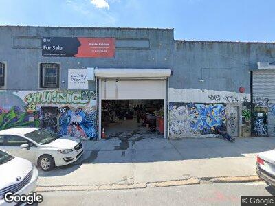
344-360 Maujer St Brooklyn, NY 11206
East Williamsburg NeighborhoodEstimated Value: $9,447,713
--
Bed
--
Bath
24,890
Sq Ft
$380/Sq Ft
Est. Value
About This Home
This home is located at 344-360 Maujer St, Brooklyn, NY 11206 and is currently estimated at $9,447,713, approximately $379 per square foot. 344-360 Maujer St is a home located in Kings County with nearby schools including MS 582 The Magnet School for Multimedia, Technology, and Urban Planning and Williamsburg Charter High School.
Ownership History
Date
Name
Owned For
Owner Type
Purchase Details
Closed on
Aug 9, 2023
Sold by
Sminn Realty Llc
Bought by
346 Maujer Llc
Current Estimated Value
Purchase Details
Closed on
May 16, 2006
Sold by
Kozer Elliot and Kozer-Rubin Realty Company Ltd
Bought by
Sminn Realty Llc
Home Financials for this Owner
Home Financials are based on the most recent Mortgage that was taken out on this home.
Original Mortgage
$1,235,000
Interest Rate
6.55%
Mortgage Type
Commercial
Create a Home Valuation Report for This Property
The Home Valuation Report is an in-depth analysis detailing your home's value as well as a comparison with similar homes in the area
Home Values in the Area
Average Home Value in this Area
Purchase History
| Date | Buyer | Sale Price | Title Company |
|---|---|---|---|
| 346 Maujer Llc | $9,150,000 | -- | |
| Sminn Realty Llc | $3,000,000 | -- |
Source: Public Records
Mortgage History
| Date | Status | Borrower | Loan Amount |
|---|---|---|---|
| Previous Owner | Sminn Realty Llc | $2,673,862 | |
| Previous Owner | Sminn Realty Llc | $951,455 | |
| Previous Owner | Sminn Realty Llc | $1,235,000 | |
| Previous Owner | Ny City Industrial Development Agency | $1,500,000 |
Source: Public Records
Tax History Compared to Growth
Tax History
| Year | Tax Paid | Tax Assessment Tax Assessment Total Assessment is a certain percentage of the fair market value that is determined by local assessors to be the total taxable value of land and additions on the property. | Land | Improvement |
|---|---|---|---|---|
| 2024 | $170,075 | $1,899,450 | $298,350 | $1,601,100 |
| 2023 | $163,047 | $1,648,800 | $298,350 | $1,350,450 |
| 2022 | $160,141 | $1,579,050 | $298,350 | $1,280,700 |
| 2021 | $158,912 | $1,543,500 | $298,350 | $1,245,150 |
| 2020 | $73,054 | $1,525,500 | $298,350 | $1,227,150 |
| 2019 | $127,272 | $1,525,500 | $298,350 | $1,227,150 |
| 2018 | $110,930 | $1,462,050 | $298,350 | $1,163,700 |
| 2017 | $95,922 | $1,345,950 | $298,350 | $1,047,600 |
| 2016 | $82,509 | $858,600 | $298,350 | $560,250 |
| 2015 | $25,761 | $860,400 | $298,350 | $562,050 |
| 2014 | $25,761 | $748,350 | $298,350 | $450,000 |
Source: Public Records
Map
Nearby Homes
- 976 Metropolitan Ave Unit 1B
- 291 Devoe St Unit 3-B
- 288 Powers St
- 18 Orient Ave
- 237 Devoe St Unit 1
- 1196 Metropolitan Ave Unit 1
- 100 Maspeth Ave Unit 2J
- 100 Maspeth Ave Unit 4L
- 850 Metropolitan Ave Unit 1I
- 850 Metropolitan Ave Unit 1E
- 850 Metropolitan Ave Unit 3B
- 217 Devoe St
- 251 Montrose Ave
- 218 Scholes St Unit 12
- 30 Bushwick Ave Unit 5B
- 30 Bushwick Ave Unit 8B
- 30 Bushwick Ave Unit 2A
- 30 Bushwick Ave Unit 7A
- 30 Bushwick Ave Unit 4B
- 30 Bushwick Ave Unit 4D