344 S Delsea Dr Cape May Court House, NJ 08210
Estimated Value: $233,000 - $341,000
6
Beds
2
Baths
1,142
Sq Ft
$238/Sq Ft
Est. Value
About This Home
This home is located at 344 S Delsea Dr, Cape May Court House, NJ 08210 and is currently estimated at $271,539, approximately $237 per square foot. 344 S Delsea Dr is a home located in Cape May County with nearby schools including Middle Township Elementary No. 1, Middle Township Elementary No. 2, and Middle Township Middle School.
Ownership History
Date
Name
Owned For
Owner Type
Purchase Details
Closed on
Feb 2, 2024
Sold by
Brunell John E and Brunell Shannon
Bought by
Brunell John E
Current Estimated Value
Purchase Details
Closed on
Oct 10, 2008
Sold by
Brunell Donald and Brunell Faith A
Bought by
Brunell John E and Brunnell Shannon
Home Financials for this Owner
Home Financials are based on the most recent Mortgage that was taken out on this home.
Original Mortgage
$137,000
Interest Rate
6.41%
Mortgage Type
Purchase Money Mortgage
Purchase Details
Closed on
Feb 26, 2005
Sold by
Rouse Diane C
Bought by
Rouse Diane C
Purchase Details
Closed on
Aug 20, 1991
Sold by
Moultrie Geraldine D
Bought by
Moultrie Geraldine B
Purchase Details
Closed on
Aug 9, 1991
Sold by
Byrd Geraldine D Moultrie
Bought by
Moultrie Geraldine D
Create a Home Valuation Report for This Property
The Home Valuation Report is an in-depth analysis detailing your home's value as well as a comparison with similar homes in the area
Home Values in the Area
Average Home Value in this Area
Purchase History
| Date | Buyer | Sale Price | Title Company |
|---|---|---|---|
| Brunell John E | -- | None Listed On Document | |
| Brunell John E | $197,000 | The Title Company Of Jersey | |
| Rouse Diane C | -- | -- | |
| Moultrie Geraldine B | -- | -- | |
| Moultrie Geraldine D | -- | -- |
Source: Public Records
Mortgage History
| Date | Status | Borrower | Loan Amount |
|---|---|---|---|
| Previous Owner | Brunell John E | $137,000 |
Source: Public Records
Tax History Compared to Growth
Tax History
| Year | Tax Paid | Tax Assessment Tax Assessment Total Assessment is a certain percentage of the fair market value that is determined by local assessors to be the total taxable value of land and additions on the property. | Land | Improvement |
|---|---|---|---|---|
| 2024 | $3,768 | $169,500 | $112,000 | $57,500 |
| 2023 | $3,668 | $169,500 | $112,000 | $57,500 |
| 2022 | $3,561 | $169,500 | $112,000 | $57,500 |
| 2021 | $3,475 | $169,500 | $112,000 | $57,500 |
| 2020 | $3,397 | $169,500 | $112,000 | $57,500 |
| 2019 | $3,321 | $169,500 | $112,000 | $57,500 |
| 2018 | $3,276 | $169,500 | $112,000 | $57,500 |
| 2017 | $3,204 | $169,500 | $112,000 | $57,500 |
| 2016 | $3,121 | $169,500 | $112,000 | $57,500 |
| 2015 | $3,088 | $169,500 | $112,000 | $57,500 |
| 2014 | $3,061 | $169,500 | $112,000 | $57,500 |
Source: Public Records
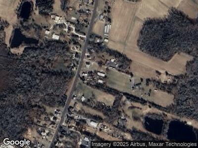
Map
Nearby Homes
- 295 S Delsea Dr
- 19 Lomurno Ln
- 1 Carmen Dr
- 600 New Jersey 47
- 235 New Jersey 47
- 302 Ridge Rd
- 262 Indian Trail Rd
- 610 S Route 47
- 17 N 15th St
- 2 S 15th St
- 17 N 10th St
- 124 Bucknell Ave
- 13 Paula Ln
- 12 N 7th St
- 9 S 6th St
- 206 Stagecoach Rd Unit 601
- 2 Lafayette Ave
- 13 Bay Ave
- 7 Lafayette Ave
- 75 Pierces Point Rd