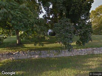
34902 State Highway 107 Griggsville, IL 62340
Estimated Value: $97,000 - $133,000
4
Beds
1
Bath
2,016
Sq Ft
$56/Sq Ft
Est. Value
About This Home
This home is located at 34902 State Highway 107, Griggsville, IL 62340 and is currently estimated at $113,457, approximately $56 per square foot. 34902 State Highway 107 is a home with nearby schools including Griggsville-Perry Primary School, Griggsville-Perry Middle School, and Griggsville-Perry High School.
Ownership History
Date
Name
Owned For
Owner Type
Purchase Details
Closed on
Aug 22, 2023
Sold by
Lowe Rachel R
Bought by
Westfall Morgan
Current Estimated Value
Home Financials for this Owner
Home Financials are based on the most recent Mortgage that was taken out on this home.
Original Mortgage
$107,000
Outstanding Balance
$105,810
Interest Rate
6.96%
Mortgage Type
New Conventional
Estimated Equity
$2,937
Purchase Details
Closed on
Aug 20, 2023
Sold by
Lowe Rachel R and Lowe Matthew C
Bought by
Lowe Rachel R
Home Financials for this Owner
Home Financials are based on the most recent Mortgage that was taken out on this home.
Original Mortgage
$107,000
Outstanding Balance
$105,810
Interest Rate
6.96%
Mortgage Type
New Conventional
Estimated Equity
$2,937
Create a Home Valuation Report for This Property
The Home Valuation Report is an in-depth analysis detailing your home's value as well as a comparison with similar homes in the area
Home Values in the Area
Average Home Value in this Area
Purchase History
| Date | Buyer | Sale Price | Title Company |
|---|---|---|---|
| Westfall Morgan | $60,000 | None Listed On Document | |
| Lowe Rachel R | -- | None Listed On Document |
Source: Public Records
Mortgage History
| Date | Status | Borrower | Loan Amount |
|---|---|---|---|
| Open | Westfall Morgan | $107,000 |
Source: Public Records
Tax History Compared to Growth
Tax History
| Year | Tax Paid | Tax Assessment Tax Assessment Total Assessment is a certain percentage of the fair market value that is determined by local assessors to be the total taxable value of land and additions on the property. | Land | Improvement |
|---|---|---|---|---|
| 2023 | $1,313 | $27,780 | $1,980 | $25,800 |
| 2022 | $1,116 | $25,380 | $1,810 | $23,570 |
| 2021 | $1,084 | $20,960 | $1,760 | $19,200 |
| 2020 | $1,122 | $20,960 | $1,760 | $19,200 |
| 2019 | $1,113 | $20,574 | $1,737 | $18,837 |
| 2018 | $1,165 | $19,270 | $1,733 | $17,537 |
| 2015 | $992 | $18,360 | $1,650 | $16,710 |
| 2013 | $992 | $18,480 | $1,660 | $16,820 |
| 2010 | $992 | $17,410 | $1,570 | $15,840 |
Source: Public Records
Map
Nearby Homes
- 43536 320th Ave
- 310 N State St
- 39360 Perry Fishhook Rd
- 702 W Quincy St
- 201 S State St
- 213 S Wall St
- 401 S Corey St
- 503 S Federal St
- 601 S Pearl St
- 487th 487th Ln
- 504 Ravenscroft
- 310 S Chestnut St
- 115 W 1st St
- 860 400 Ave N
- 64 200 Ave N
- 668 390 Ave N
- 328 S Washington
- 320 S Washington
- 521 Pearl
- 328 S N Washington St
