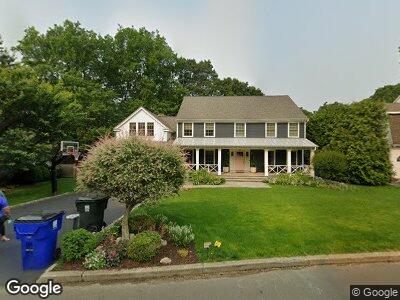
351 Orchard Hill Ln Fairfield, CT 06824
University NeighborhoodEstimated Value: $753,000 - $1,798,000
4
Beds
3
Baths
3,867
Sq Ft
$366/Sq Ft
Est. Value
About This Home
This home is located at 351 Orchard Hill Ln, Fairfield, CT 06824 and is currently estimated at $1,413,777, approximately $365 per square foot. 351 Orchard Hill Ln is a home located in Fairfield County with nearby schools including Osborn Hill Elementary School, Fairfield Woods Middle School, and Fairfield Ludlowe High School.
Ownership History
Date
Name
Owned For
Owner Type
Purchase Details
Closed on
Jan 23, 2017
Sold by
Boyer Charlene T
Bought by
Nori Beth A and Nori Rino C
Current Estimated Value
Purchase Details
Closed on
Jul 1, 2009
Sold by
Garfield Victoria G
Bought by
Nori Rino C and Nori Beth A
Purchase Details
Closed on
Jun 25, 2000
Sold by
Bombace Theresa
Bought by
Garfield Ii John F and Garfield Victoria G
Create a Home Valuation Report for This Property
The Home Valuation Report is an in-depth analysis detailing your home's value as well as a comparison with similar homes in the area
Home Values in the Area
Average Home Value in this Area
Purchase History
| Date | Buyer | Sale Price | Title Company |
|---|---|---|---|
| Nori Beth A | $340,000 | -- | |
| Nori Beth A | $340,000 | -- | |
| Nori Rino C | $995,000 | -- | |
| Nori Rino C | $995,000 | -- | |
| Garfield Ii John F | $648,000 | -- | |
| Garfield John F | $648,000 | -- |
Source: Public Records
Mortgage History
| Date | Status | Borrower | Loan Amount |
|---|---|---|---|
| Previous Owner | Bombace Theresa | $601,450 | |
| Previous Owner | Bombace Theresa | $150,000 |
Source: Public Records
Tax History Compared to Growth
Tax History
| Year | Tax Paid | Tax Assessment Tax Assessment Total Assessment is a certain percentage of the fair market value that is determined by local assessors to be the total taxable value of land and additions on the property. | Land | Improvement |
|---|---|---|---|---|
| 2024 | $20,592 | $738,080 | $304,780 | $433,300 |
| 2023 | $20,305 | $738,080 | $304,780 | $433,300 |
| 2022 | $19,836 | $728,210 | $304,780 | $423,430 |
| 2021 | $19,647 | $728,210 | $304,780 | $423,430 |
| 2020 | $17,939 | $669,620 | $301,630 | $367,990 |
| 2019 | $17,320 | $646,520 | $301,630 | $344,890 |
| 2018 | $17,042 | $646,520 | $301,630 | $344,890 |
| 2017 | $16,693 | $646,520 | $301,630 | $344,890 |
| 2016 | $16,454 | $646,520 | $301,630 | $344,890 |
| 2015 | $16,362 | $660,030 | $317,450 | $342,580 |
| 2014 | $16,105 | $660,030 | $317,450 | $342,580 |
Source: Public Records
Map
Nearby Homes
- 263 Lower Farm Rd Unit Lot 4
- 53 Lower Farm Rd Unit lot 1
- 1906 Mill Plain Rd
- 79 Cynthia Dr
- 183 Pepperidge Cir
- 181 Riverview Cir
- 42 Valley View Rd
- 2470 N Benson Rd
- 1333 Round Hill Rd
- 1569 Brookside Dr
- 120 Mountain Laurel Rd
- 124 Szost Dr
- 14 Knollwood Dr
- 147 Trillium Rd
- 540 Wormwood Rd
- 142 Trillium Rd
- 71 Reid St
- 296 Sigwin Dr
- 411 Wormwood Rd
- 628 Katona Dr