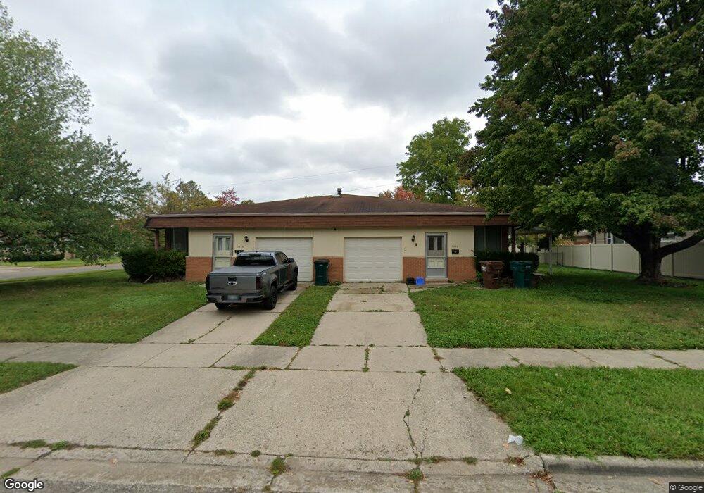
3526 Gingersnap Ln Lansing, MI 48911
Averill Woods NeighborhoodEstimated Value: $242,000 - $263,000
3
Beds
1
Bath
2,594
Sq Ft
$97/Sq Ft
Est. Value
About This Home
This home is located at 3526 Gingersnap Ln, Lansing, MI 48911 and is currently estimated at $250,887, approximately $96 per square foot. 3526 Gingersnap Ln is a home located in Ingham County with nearby schools including Averill New Tech Elementary School, Attwood School, and J.W. Sexton High School.
Ownership History
Date
Name
Owned For
Owner Type
Purchase Details
Closed on
Jun 27, 2024
Sold by
Gingersnap Rental
Bought by
Leverett Kenneth
Current Estimated Value
Home Financials for this Owner
Home Financials are based on the most recent Mortgage that was taken out on this home.
Original Mortgage
$245,471
Outstanding Balance
$244,857
Interest Rate
6.94%
Mortgage Type
FHA
Estimated Equity
$30,173
Purchase Details
Closed on
Apr 22, 2014
Sold by
Kuhn Kurt A and Kuhn Terry Linn
Bought by
Gingersnap Rental
Purchase Details
Closed on
Aug 7, 1992
Sold by
Kuhn Charles and Kuhn Donna
Bought by
Kuhn Charles and Kuhn Donna
Purchase Details
Closed on
Nov 17, 1981
Sold by
Linn Alvin J and Linn Edna
Bought by
Kuhn Charles and Kuhn Donna
Purchase Details
Closed on
Jul 25, 1973
Sold by
Rashid Phillip G and Rashid Mary P
Bought by
Linn Aj and Linn Edna
Create a Home Valuation Report for This Property
The Home Valuation Report is an in-depth analysis detailing your home's value as well as a comparison with similar homes in the area
Home Values in the Area
Average Home Value in this Area
Purchase History
| Date | Buyer | Sale Price | Title Company |
|---|---|---|---|
| Leverett Kenneth | $250,000 | Greater Lansing Title | |
| Gingersnap Rental | -- | None Available | |
| Kuhn Charles | -- | -- | |
| Kuhn Charles | -- | -- | |
| Linn Aj | $48,900 | -- |
Source: Public Records
Mortgage History
| Date | Status | Borrower | Loan Amount |
|---|---|---|---|
| Open | Leverett Kenneth | $245,471 |
Source: Public Records
Tax History Compared to Growth
Tax History
| Year | Tax Paid | Tax Assessment Tax Assessment Total Assessment is a certain percentage of the fair market value that is determined by local assessors to be the total taxable value of land and additions on the property. | Land | Improvement |
|---|---|---|---|---|
| 2025 | $4,048 | $124,900 | $15,600 | $109,300 |
| 2024 | $33 | $119,400 | $15,600 | $103,800 |
| 2023 | $3,813 | $104,000 | $15,600 | $88,400 |
| 2022 | $3,486 | $94,900 | $15,600 | $79,300 |
| 2021 | $3,406 | $52,300 | $14,700 | $37,600 |
| 2020 | $3,381 | $51,300 | $14,700 | $36,600 |
| 2019 | $3,263 | $45,800 | $14,700 | $31,100 |
| 2018 | $3,097 | $41,600 | $14,700 | $26,900 |
| 2017 | $2,980 | $41,600 | $14,700 | $26,900 |
| 2016 | $6,368 | $68,000 | $14,700 | $53,300 |
| 2015 | $6,368 | $62,200 | $29,402 | $32,798 |
| 2014 | $6,368 | $85,900 | $29,402 | $56,498 |
Source: Public Records
Map
Nearby Homes
- 3505 Brisbane Dr
- 3700 Malibu Dr
- 3115 Rayborn Dr
- 2800 S Waverly Hwy
- 3715 Glasgow Dr
- 3207 Sunderland Rd
- 3200 Lawdor Rd
- 2 Locust Ln
- 3701 Starlight Ln
- 3406 Glasgow Dr
- 4125 Harbour Cove
- 3523 Cooley Dr
- 3811 Cooley Dr
- 3119 Norwich Rd
- 3226 Glasgow Dr
- 3230 S Deerfield Ave
- 0 S Deerfield Ave
- 3413 Churchill Ave
- 3508 Muirfield Dr
- 3100 Glenbrook Dr
- 2907 Averill Dr
- 3518 Gingersnap Ln
- 2909 Averill Dr
- 3525 Sandhurst Dr
- 3512 Gingersnap Ln
- 3517 Sandhurst Dr
- 3001 Averill Dr
- 3525 Gingersnap Ln
- 2914 Averill Dr
- 3519 Ginger Snap Ln
- 2920 Averill Dr
- 2908 Averill Dr
- 3511 Sandhurst Dr
- 3506 Gingersnap Ln
- 2926 Averill Dr
- 3513 Gingersnap Ln
- 3601 Sandhurst Dr
- 3505 Sandhurst Dr
- 3000 Averill Dr