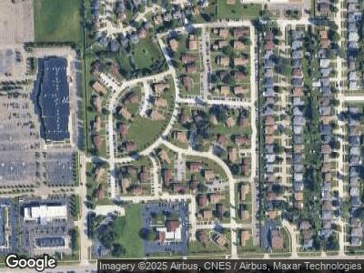
35462 Townley Dr Unit 55 271 Sterling Heights, MI 48312
Estimated Value: $150,156 - $163,000
3
Beds
2
Baths
1,200
Sq Ft
$130/Sq Ft
Est. Value
About This Home
This home is located at 35462 Townley Dr Unit 55 271, Sterling Heights, MI 48312 and is currently estimated at $156,539, approximately $130 per square foot. 35462 Townley Dr Unit 55 271 is a home located in Macomb County with nearby schools including Willow Woods Elementary School, Carleton Middle School, and Sterling Heights Senior H.S..
Ownership History
Date
Name
Owned For
Owner Type
Purchase Details
Closed on
Oct 29, 2009
Sold by
Wong Yuk Ling
Bought by
Bekric Mustafa and Bekric Mina
Current Estimated Value
Purchase Details
Closed on
May 7, 2009
Sold by
The Bank Of New York Trust Company Na
Bought by
The Bank Of New York Mellon Trust Compan and The Bank Of New York Trust Company Na
Purchase Details
Closed on
Feb 6, 2009
Sold by
Perse Alan T
Bought by
The Bank Of New York Trust Company Na and The Bank Of New York Mellon Trust Compan
Purchase Details
Closed on
Mar 7, 2002
Sold by
Sterling I Llc
Bought by
Perse Alan T
Home Financials for this Owner
Home Financials are based on the most recent Mortgage that was taken out on this home.
Original Mortgage
$102,179
Interest Rate
7.16%
Create a Home Valuation Report for This Property
The Home Valuation Report is an in-depth analysis detailing your home's value as well as a comparison with similar homes in the area
Home Values in the Area
Average Home Value in this Area
Purchase History
| Date | Buyer | Sale Price | Title Company |
|---|---|---|---|
| Bekric Mustafa | $54,000 | None Available | |
| The Bank Of New York Mellon Trust Compan | -- | E Title Agency | |
| The Bank Of New York Trust Company Na | $118,206 | None Available | |
| Perse Alan T | -- | -- |
Source: Public Records
Mortgage History
| Date | Status | Borrower | Loan Amount |
|---|---|---|---|
| Previous Owner | Perse Alan T | $113,810 | |
| Previous Owner | Perse Alan | $106,300 | |
| Previous Owner | Perse Alan T | $102,179 |
Source: Public Records
Tax History Compared to Growth
Tax History
| Year | Tax Paid | Tax Assessment Tax Assessment Total Assessment is a certain percentage of the fair market value that is determined by local assessors to be the total taxable value of land and additions on the property. | Land | Improvement |
|---|---|---|---|---|
| 2024 | $1,078 | $61,000 | $0 | $0 |
| 2023 | $1,023 | $58,100 | $0 | $0 |
| 2022 | $992 | $51,300 | $0 | $0 |
| 2021 | $1,025 | $49,900 | $0 | $0 |
| 2020 | $975 | $51,400 | $0 | $0 |
| 2019 | $961 | $48,500 | $0 | $0 |
| 2018 | $969 | $44,800 | $0 | $0 |
| 2017 | $935 | $44,000 | $5,500 | $38,500 |
| 2016 | $915 | $44,000 | $0 | $0 |
| 2015 | -- | $31,700 | $0 | $0 |
| 2014 | -- | $20,200 | $0 | $0 |
Source: Public Records
Map
Nearby Homes
- 35463 Turner Dr Unit 266
- 35505 Townley Dr
- 35522 Townley Dr Unit 259
- 35299 Terrybrook Dr
- 35389 Tall Oaks Dr Unit 132
- 35651 Eastmont Dr
- 11081 15 Mile Rd
- 35853 Ashford Dr
- 8625 Brougham Dr
- 11065 Forrer Dr
- 8286 Heywood Cir Unit 3
- 8316 Heywood Cir Unit 12
- 11098 Canterbury Dr
- 8280 Heywood Cir Unit 2
- 35457 Wellston Ave
- 8524 Hickory Dr Unit 8524
- 35464 Evanston Ave
- 36476 Summerset St
- 34339 Daventry Ct
- 8623 Greendale Dr
