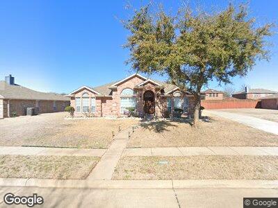
363 Montana Trail Murphy, TX 75094
Estimated Value: $483,000 - $494,000
4
Beds
2
Baths
2,418
Sq Ft
$203/Sq Ft
Est. Value
About This Home
This home is located at 363 Montana Trail, Murphy, TX 75094 and is currently estimated at $490,515, approximately $202 per square foot. 363 Montana Trail is a home located in Collin County with nearby schools including Tibbals Elementary School, Dr. Al Draper Intermediate Middle School, and Raymond B Cooper J High School.
Ownership History
Date
Name
Owned For
Owner Type
Purchase Details
Closed on
Jul 24, 2017
Sold by
Pham Tuong and Pham Si Nhu
Bought by
Liang Tai He and Liang Jinmin Lu
Current Estimated Value
Home Financials for this Owner
Home Financials are based on the most recent Mortgage that was taken out on this home.
Original Mortgage
$180,000
Outstanding Balance
$152,413
Interest Rate
3.89%
Mortgage Type
New Conventional
Estimated Equity
$338,102
Purchase Details
Closed on
Feb 21, 2006
Sold by
D R Horton Texas Ltd
Bought by
Pham Tuong
Home Financials for this Owner
Home Financials are based on the most recent Mortgage that was taken out on this home.
Original Mortgage
$142,300
Interest Rate
6.1%
Mortgage Type
Fannie Mae Freddie Mac
Create a Home Valuation Report for This Property
The Home Valuation Report is an in-depth analysis detailing your home's value as well as a comparison with similar homes in the area
Home Values in the Area
Average Home Value in this Area
Purchase History
| Date | Buyer | Sale Price | Title Company |
|---|---|---|---|
| Liang Tai He | -- | None Available | |
| Pham Tuong | -- | None Available |
Source: Public Records
Mortgage History
| Date | Status | Borrower | Loan Amount |
|---|---|---|---|
| Open | Liang Tai He | $180,000 | |
| Previous Owner | Pham Tuong | $140,000 | |
| Previous Owner | Pham Tuong | $143,000 | |
| Previous Owner | Pham Tuong | $17,000 | |
| Previous Owner | Pham Tuong | $142,300 |
Source: Public Records
Tax History Compared to Growth
Tax History
| Year | Tax Paid | Tax Assessment Tax Assessment Total Assessment is a certain percentage of the fair market value that is determined by local assessors to be the total taxable value of land and additions on the property. | Land | Improvement |
|---|---|---|---|---|
| 2023 | $6,079 | $373,188 | $115,000 | $352,394 |
| 2022 | $7,113 | $339,262 | $95,000 | $308,596 |
| 2021 | $6,798 | $308,420 | $75,000 | $233,420 |
| 2020 | $7,124 | $311,133 | $75,000 | $236,133 |
| 2019 | $7,331 | $306,476 | $75,000 | $231,476 |
| 2018 | $7,188 | $298,007 | $65,000 | $233,007 |
| 2017 | $6,594 | $279,186 | $60,000 | $219,186 |
| 2016 | $6,063 | $257,673 | $60,000 | $197,673 |
| 2015 | $4,879 | $232,967 | $50,000 | $182,967 |
Source: Public Records
Map
Nearby Homes
- 407 Sagebrush Trail
- 416 Gene Autry Ln
- 432 Ponderosa Trail
- 605 Gene Autry Ln
- 645 Wyoming Dr
- 618 Lone Ridge Way
- 6806 Audubon Dr
- 617 Avalanche Dr
- 611 Comanche Trail
- 506 Pecos Path Dr
- 1114 Crosswind Dr
- 501 Windward Dr
- 3611 Hogge Dr
- 1202 Crestwick Dr
- 729 Steppe Dr
- 613 Windward Dr
- 721 Lowveld Dr
- 400 Laurel Hill Ln
- 1127 Westminster Ave
- 405 Whisperfield Dr